The project focuses on Kamehameha Highway from Likelike Highway to Kahekili Highway, Haʻikū Road between Kahekili Highway and Kamehameha Highway, and Kāneʻohe Bay Drive between Mōkapu Saddle Road and Mōkapu Boulevard. Roadway improvements on Keaʻahala Road between Kahekili Highway and Kamehameha Highway will also be implemented in future roadway repaving projects. The first improvements to advance will be those along Haʻikū Road, Kamehameha Highway from Likelike Highway to Haʻikū Road, and Kāneʻohe Bay Drive, which are currently in the project design phase. The project plans are available below.
The Opportunity
The City is looking at major roadways in Kāneʻohe with the aim of improving safety for all users.The goal of the Kāneʻohe project is to find ways to make the area safe, inviting, and usable for all. The project’s roadway improvements will be implemented as part of future roadway paving projects, which are currently beginning the design and documentation phase. Complete Streets are:
Safe and convenient for people of all ages and abilities
Accommodating to all modes, including foot, bicycle, transit, and automobile
Integrated with the community’s vision and sense of place
Supportive of community health and transportation equity
If you require an auxiliary aid/service, other accommodation due to a disability, or an interpreter for a language other than English, to read these plans, please call Daniel Alexander at (808) 768-6652 or email completestreets@honolulu.gov
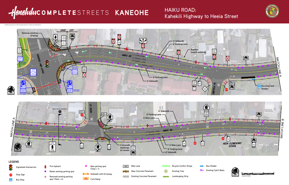
Haʻikū Road Plans
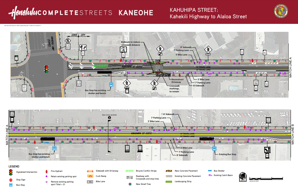
Kahuhipa Street Plans
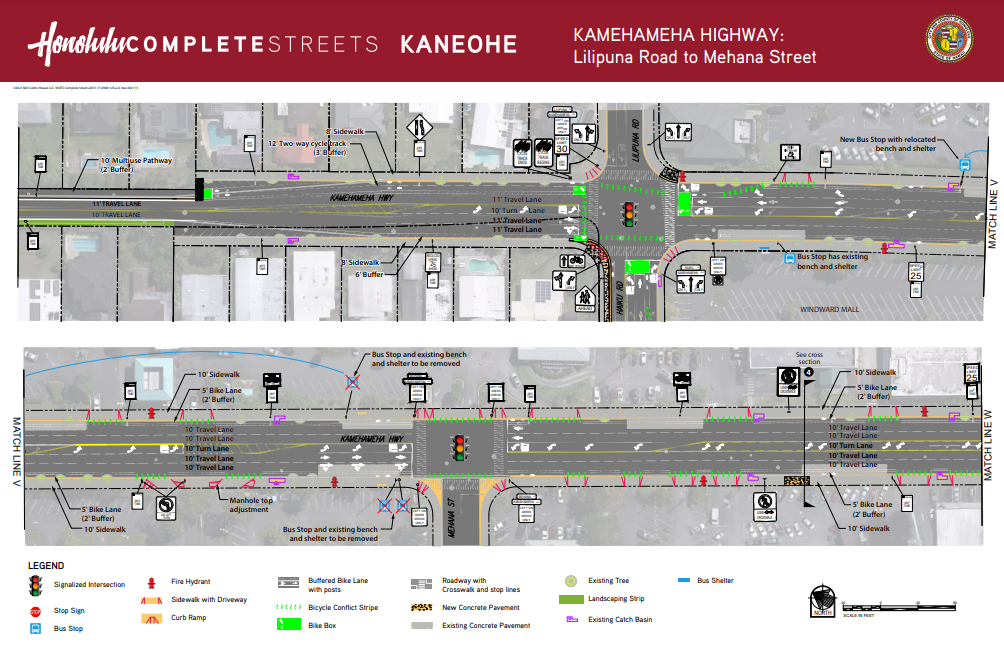
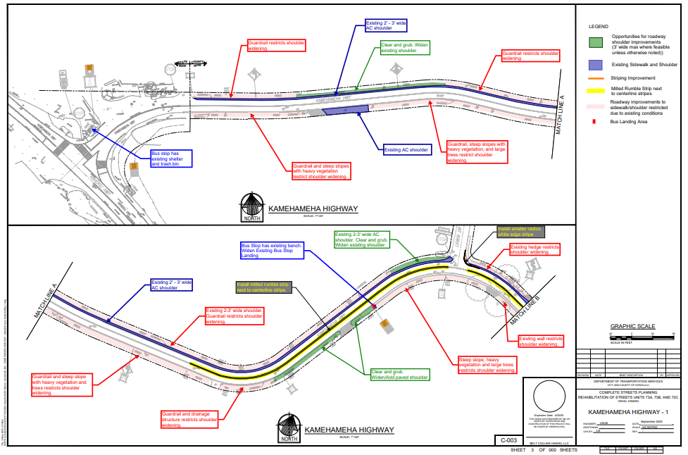
Kamehameha Highway Plans
Kamehameha Highway Plans
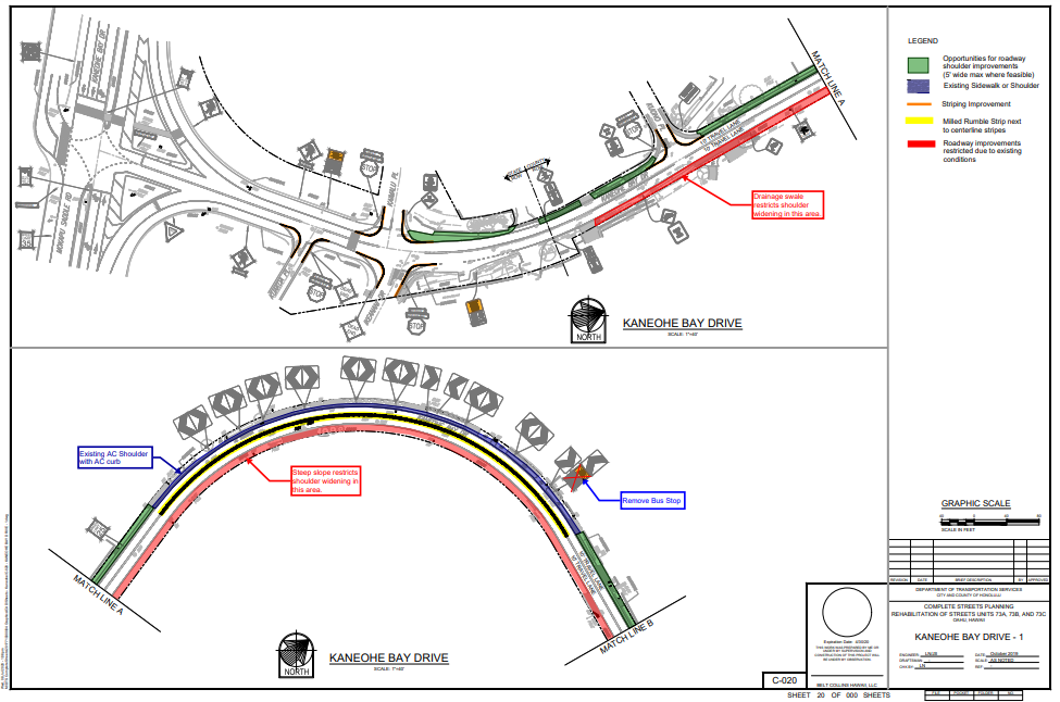
Kāneʻohe Bay Drive Plans
Community Meetings
The City and County of Honolulu’s Department of Transportation Services conducted public outreach in 2018 and 2019 for community input on the project. Public meetings, various pop-up and community events, and online surveys to engage the public and solicit their input on the Oʻahu Pedestrian Plan were hosted.
Click images and links below to view presentation slides and additional meeting materials.
Click on the interactive map to view community comments about issues residents encountered, or ideas community members have to make the area safer and more accessible for all.
How to Use:
Scroll and move the map to Kāneʻohe
Click from a selection of suggestions or add your own ideas and pin them at the location you desire