The City and County of Honolulu has several ongoing Complete Streets improvements in the works for the Kalihi neighborhood. These projects will contribute to create a network of streets that are safe and convenient for all people, whether they are traveling by foot, bicycle, transit, or ride-share, and regardless of age or ability. Projects include:
North King Street from Liliha Street to Middle Street
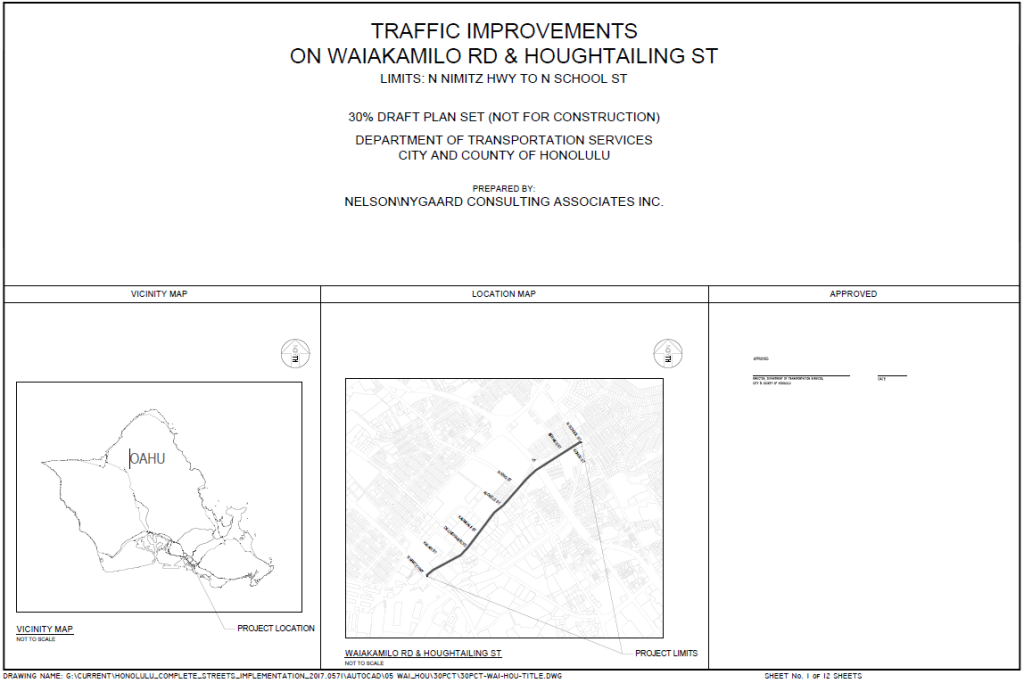
Waiakamilo Road/Houghtailing Street from Nimitz Highway to School Street
North School Street from Queen Emma through its transition into Middle Street ending at Dillingham Boulevard
The Opportunity
Complete Streets are part of a transportation and design approach that aims to create a comprehensive, integrated network of streets for all people whether traveling by foot, bicycle, transit, or automobile. Complete Streets are:
Safe and convenient for people of all ages and abilities
Accommodating to all modes, including foot, bicycle, transit, and automobile
Integrated with the community’s vision and sense of place
Supportive of community health and transportation equity
Click thumbnails to view or download a PDF of plans.
If you require an auxiliary aid/service, other accommodation due to a disability, or an interpreter for a language other than English, to read these plans, please call Daniel Alexander at (808) 768-6652 or email completestreets@honolulu.gov.
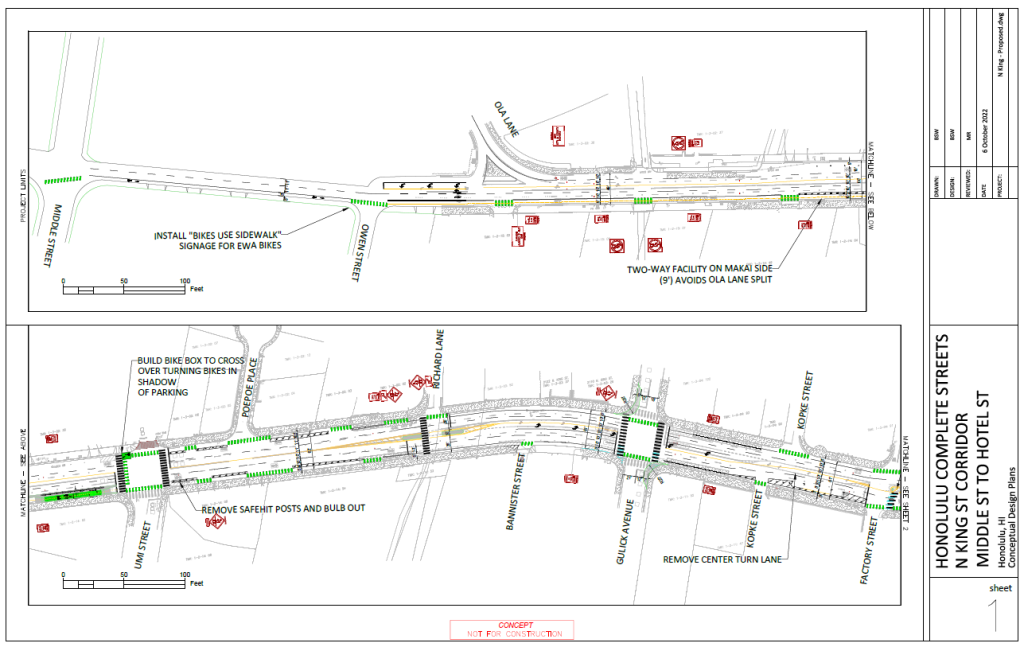
North King Street from Middle Street to Hotel Street Plans
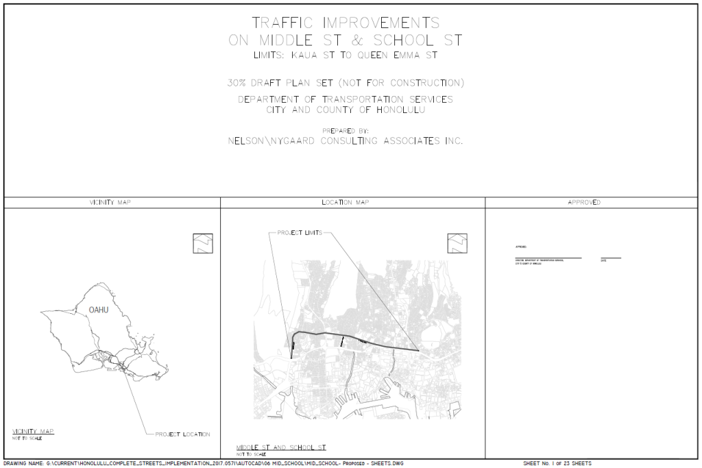
School Street & Middle Street from Kaua Street to Queen Emma Street Final Concept Plans
Waiakamilo Road/Houghtailing Street from Nimitz Highway to School Street Plans
Community Meetings
Click links below to view recorded presentations, slides and additional meeting materials.
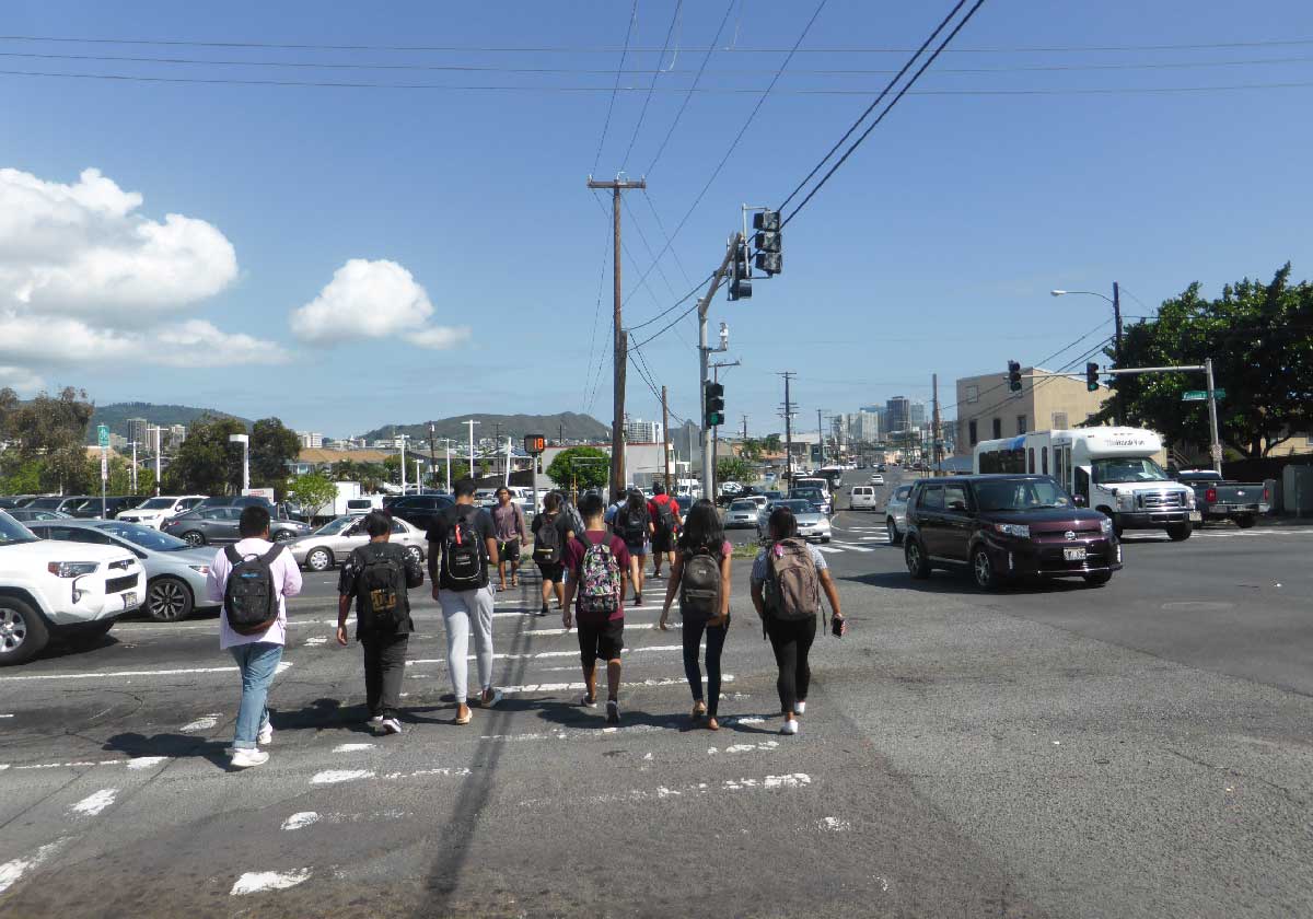
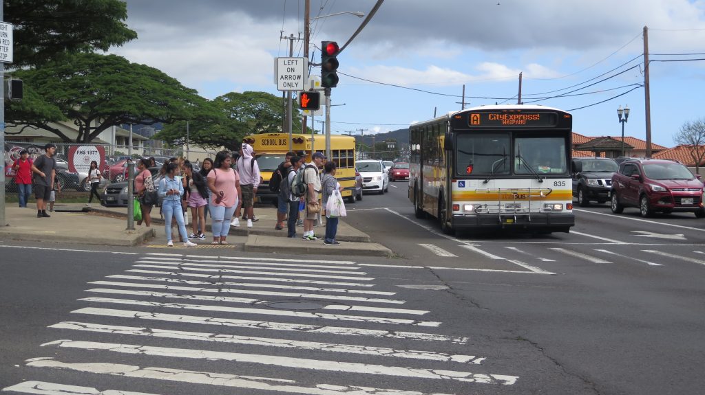
Following requests to improve safety on Kalihi streets and years of community meetings and surveys to identify specific improvements, the City sought feedback on projects for a number of key Kalihi streets: North King Street, North School Street, Middle Street, Houghtailing Street, and Waiakamilo Road. The improvements will include pedestrian crossing beacons, pedestrian crossing islands, curb extensions, bike lanes, and traffic calming. These improvements were developed based on public input gathered over the past several years.
Walkway Improvements
The City and County of Honolulu has roughly 900 miles of missing walkways along our local roadways, and building them is a complex and costly endeavor. The new Oʻahu Pedestrian Plan prioritizes our missing walkways based on an analysis that considers factors such as bus routes, proximity to schools, and crash history. Moving forward, pending the availability of funds, the City’s Complete Streets program will explore opportunities to construct walkways along these priority segments, either as stand-alone improvements or part of a periodic roadway and pavement rehabilitation projects.
Locations identified for safety improvements:
Pālama Street (North King Street to Vineyard Boulevard)
Gulick Avenue (North King Street to North School Street)
Beckley Street (Gulick Avenue to Kalihi Street)
Puʻuhale Road (Nimitz Highway to Dillingham Boulevard)
Kānoa Street (Pālama Street to Pua Lane)
Interactive Map
Click on the interactive map to view community comments about issues residents encountered, or ideas community members have to make the area safer and more accessible for all.
How To Use:
Scroll and move the map to Kalihi
Click from a selection of suggestions or add your own ideas and pin them at the location you desire