Storm Water Quality

Green Stormwater Infrastructure

Green Stormwater Infrastructure uses or mimics the natural landscape to treat storm water at the source of pollution and may also reduce flooding and improve aesthetics. Green Stormwater Infrastructure includes the capture and reuse of rainwater, for more on rainwater capture see the Contain the Rain webpage.

Types of Green Stormwater Infrastructure Best Management Practices (BMPs), also referred to as Treatment Control BMPs, are listed below with examples. Additional BMPs for homeowners can be found on the Residents webpage.

Retention/Infiltration Best Management Practices

BMPs using retention treat storm water by retaining runoff onsite. The runoff absorbed into the soil and/or evaporated directly or via plants.

Parking lot infiltration.

Infiltration Trench

A rock filled trench with no outlet where stormwater is stored between the rocks and infiltrates into the soil.

Subsurface infiltration system.

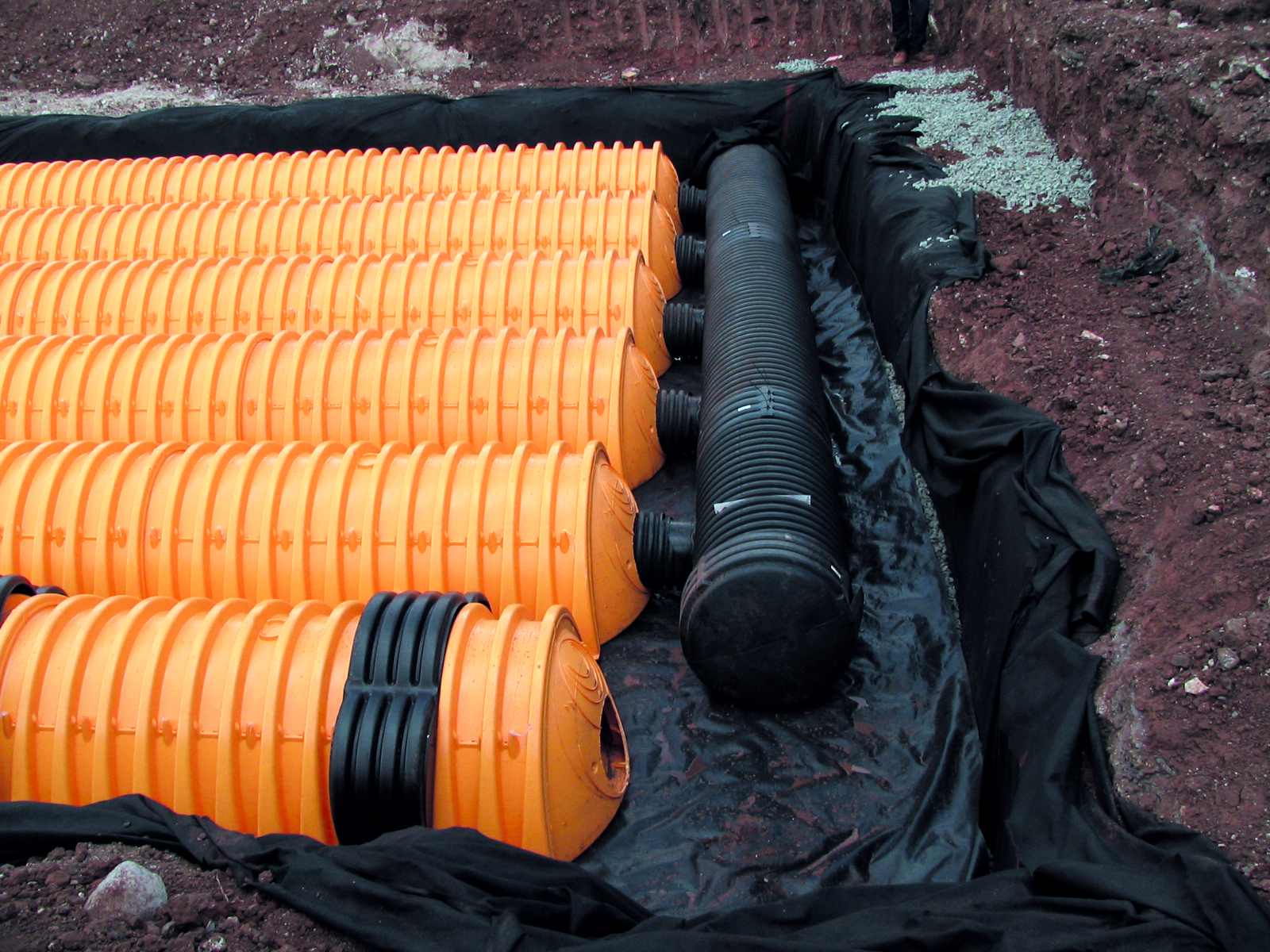
Subsurface Infiltration System

A rock or pre-manufactured material that stores runoff below surfaces such as parking lots, lawns and playfields for temporary storage and infiltration of runoff.
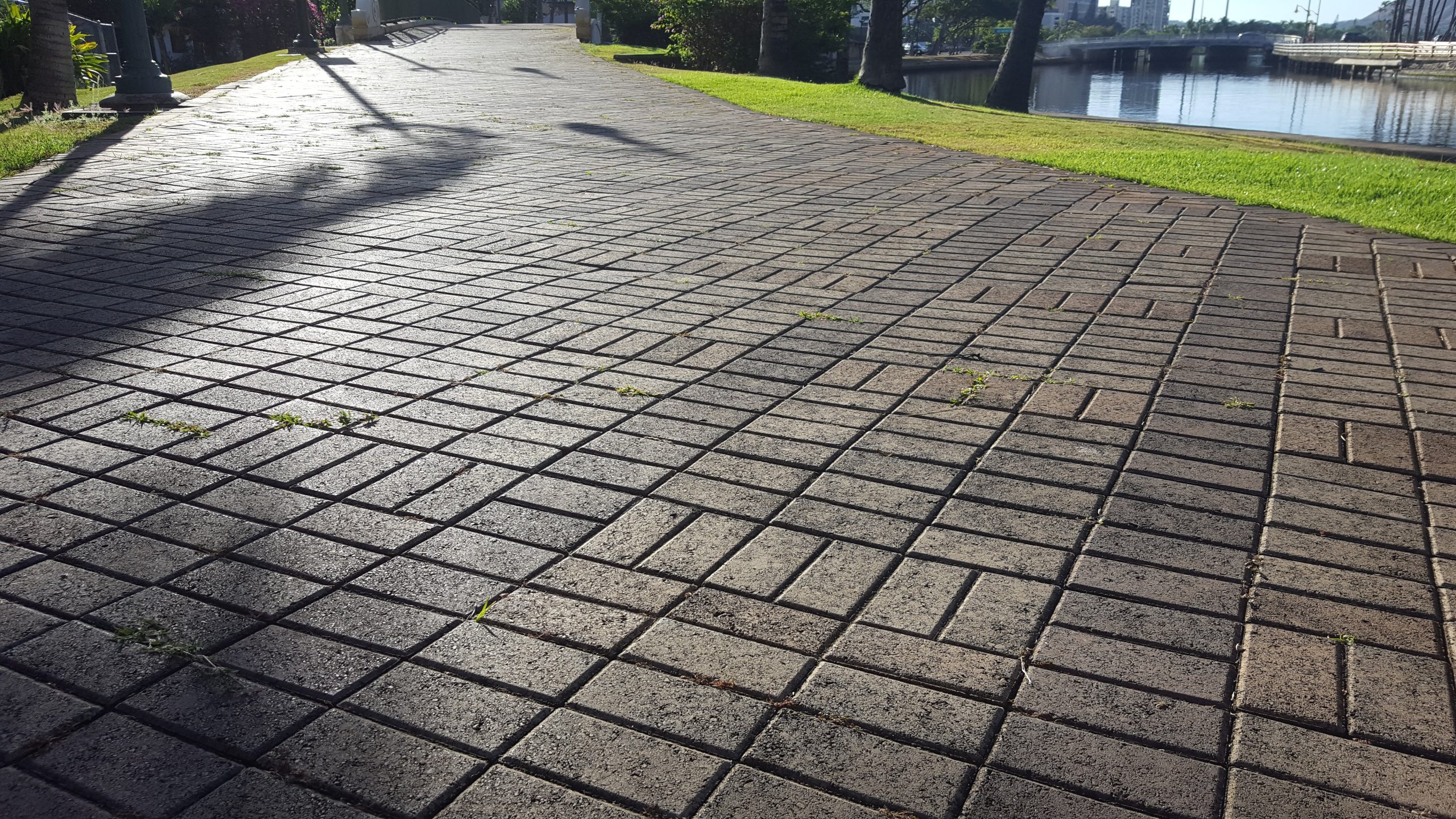
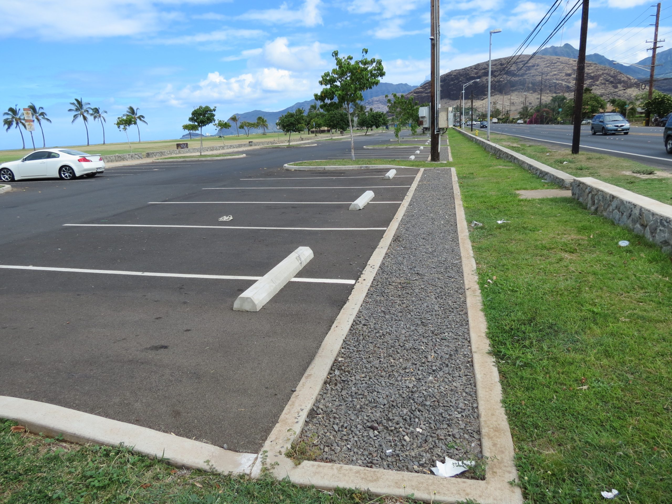
Permeable pavement along the Ala Wai Canal.

Permeable Pavement

Any porous, load-bearing surface that allows for temporary rainwater storage in an underlying aggregate layer until it infiltrates into the soil. Permeable pavements include pervious concrete, porous asphalt or interlocking pavers (without grout).

A rain barrel.

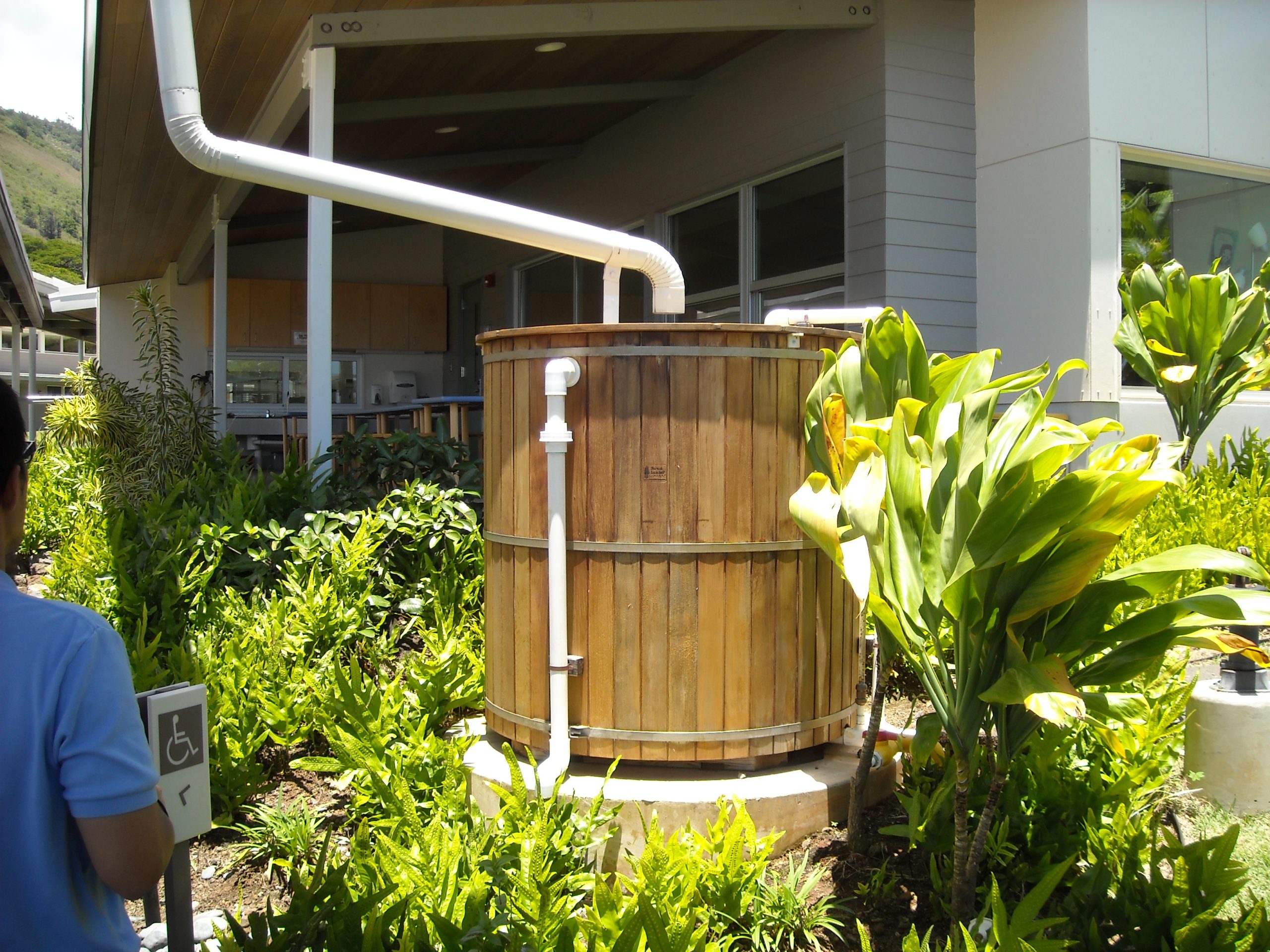
Rainwater Harvesting

The collection and temporary storage of roof runoff in rain barrels or cisterns for non-potable use (landscape irrigation, vehicle washing and other uses as allowed by the City Building Code). Sometimes referred to as Capture/Reuse or Harvest/Reuse.

A rain garden.

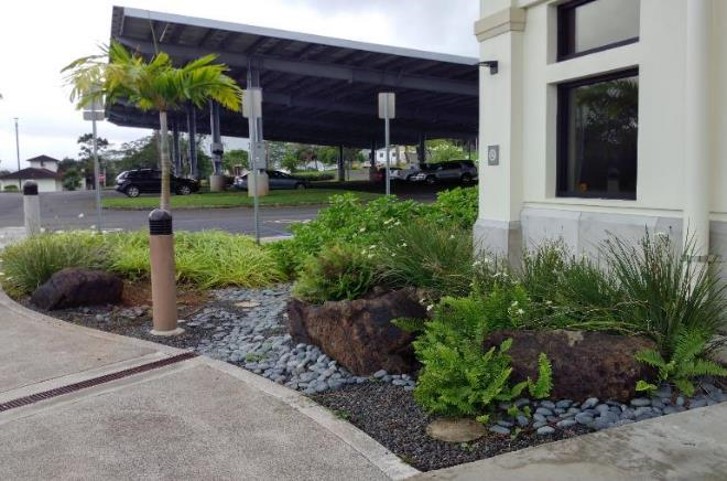
Bioretention Basin or Rain Garden

An engineered shallow depression that collects and filters storm water runoff using conditioned planting soil beds and vegetation.

Infiltration Basin

A shallow depression where runoff is stored until infiltrates in the ground through the bottom of the basin.

Dry Well

A below ground aggregate-filled or prefabricated perforated storage facility, where roof runoff is stored and infiltrates into the soil.

Biofiltration Best Management Practices

BMPs using biofiltration remove pollutants from runoff by filtering storm water through vegetation and soils.

A vegetated swale.

Vegetated Swale

A broad shallow earthen channel vegetated with erosion resistant and flood tolerant grasses. Runoff typically enters the swale at one end and exits at the other end. Sometimes referred to as a Grass Swale, Grass Channel, or Biofiltration Swale.

Enhanced Swale

A shallow linear channel with a planting bed and covered with turf or other surface material (other than mulch or plants). Runoff filters through a planting bed, is collected in an underdrain system, and discharged at the downstream end of the swale. Sometimes referred to as a Dry Swale or Bioretention Swale.

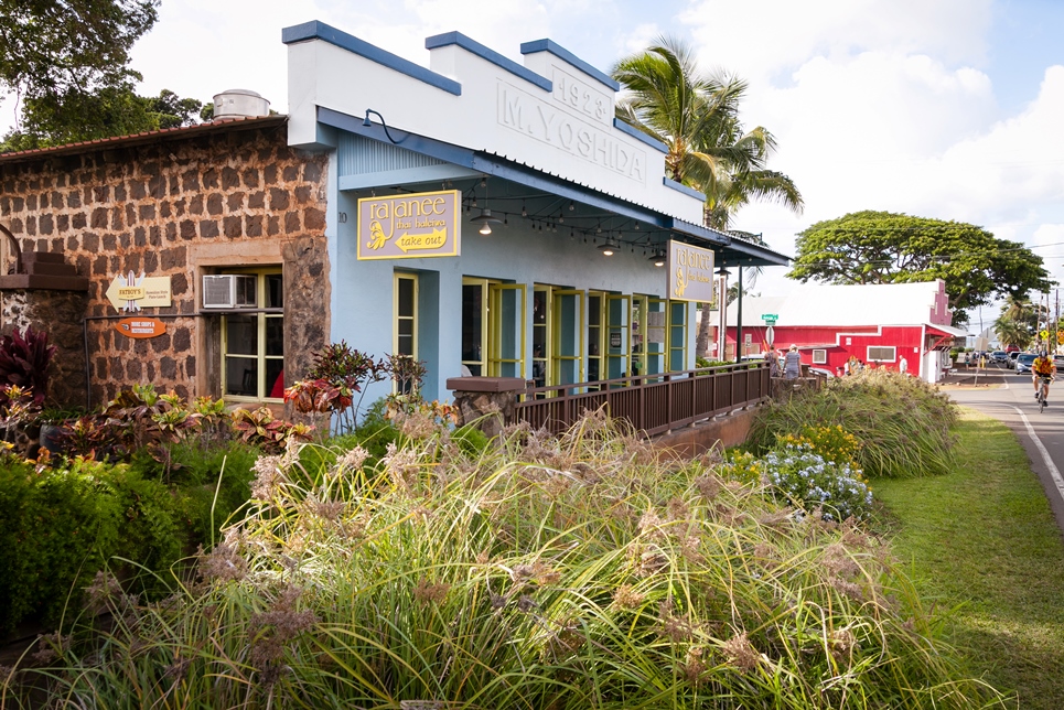
Vegetated Buffer Strip

A grass slope vegetated with turf grass that is designed to accommodate sheet flow. Sometimes referred to as a Vegetated Filter Strip or Biofiltration Strip.

Vegetated Biofilter

An engineered or proprietary system that collects and filters storm water runoff using conditioned planting soil beds and vegetation. Sometimes referred to as Bioretention Filter, Stormwater Curb Extension, Tree Box Filter, or Planter Box.
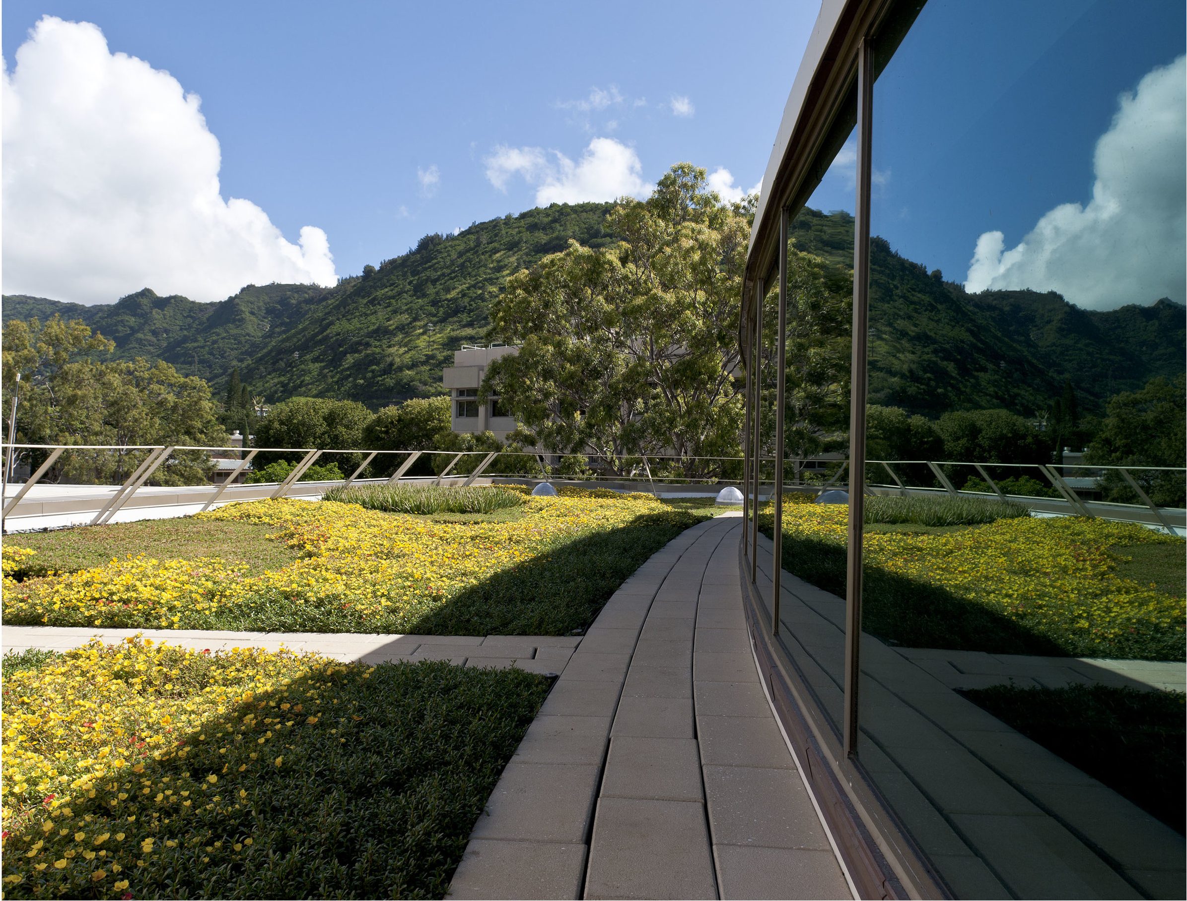
An example of a green roof.

Green Roofs

A roof that is entirely or partially covered with vegetation and soils for the purpose of filtering, absorbing, evapotranspirating, and retaining detaining the rain that falls upon it. Sometimes referred to as a Vegetated Roof or Eco-roof.

Other Best Management Practices

A downspout extention.

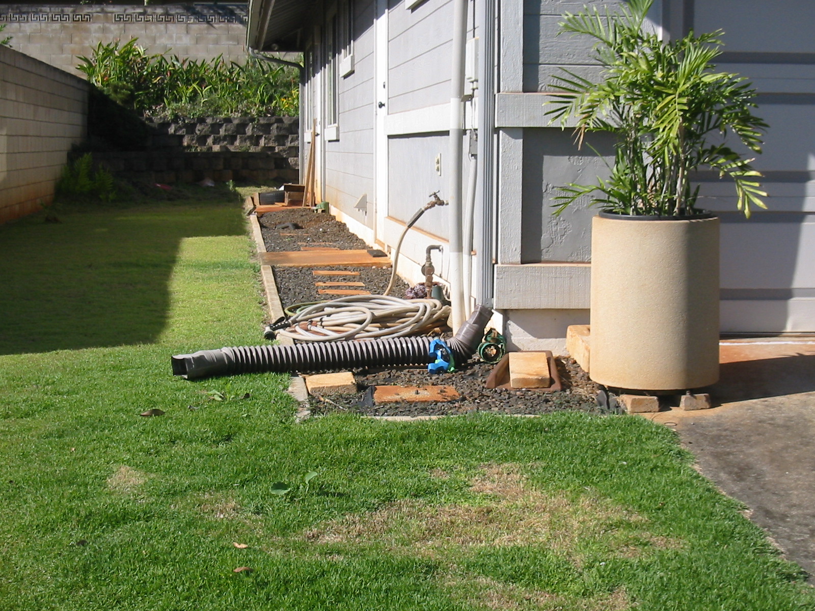
Downspout Disconnection

Redirecting water from roofs that was flowing to a driveway, sidewalk or street and redirecting it to be absorbed into soil or collecting it for reuse.

An example of a planter box.

Planter Boxes

Rain gardens or biofilters with walls that collect and absorb water from streets and sidewalks and are typically found in downtown areas.

An example of an urban tree canopy.

Urban Tree Canopy

Using trees in an urban area to absorb storm water in their leaves and branches, thereby reducing runoff.

An example of a detention basin.

Detention Basin

A shallow man-made impoundment for the temporary storage of storm water runoff to allow particles to settle. It does not have a permanent pool and is designed to drain between storm events.

For Windward Residents

The Follow the Drop app can assist you in designing and placing green stormwater infrastructure on your property. The app is currently available for use on the Windward side from Waimanalo to Kaʻaʻawa until summer 2024. Download via links below and use Account ID “808”.

Apple Store

Google Play

Free rainwater assessments by Hui o Ko’olaupoko are also available. Sign up at rainwaterhawaii.com.

Locations of Low Impact Developments on O‘ahu

The Hawaiʻi LID Atlas is a collection of alternative stormwater management practices currently installed across the state. The Atlas is hosted by the National Nonpoint Education for Municipal Officials (NEMO) Network and the University of Hawaiʻi Sea Grant Program. It is an online resource providing geo-referenced examples of green infrastructure and low impact development for stormwater management.

You can browse the Atlas by either selecting a town, land use type, project type or by simply clicking on pinned sites. You can add your own project to the atlas by filling out the Hawaiʻi LID Atlas Submission Form.

City and County of Honolulu Projects Registered on ‘Hawai‘i LID Atlas’

Ala Wai Golf Course

Ala Wai Neighborhood and Community Park

Kapolei Police Station

Kapi‘olani Regional Park

Kalihi Police Station

Kuapā Pond

Māʻili Beach Park

Wahiawā Police Station

Wai‘anae Police Station

Kumuhau Street

Other Resources

American Society for Landscape Architects

City Storm Water System Map

EPA report on flood avoidance using green infrastructure

Green Infrastructure Summit; August 9-10, 2016; Honolulu, HI

I-Tree Hydro

National League of Cities – Sustainable Cities Institute

O‘ahu Tree Canopy Map

Scroll to Top
Skip to content