Waikīkī
Project Overview
Waikīkī is a dense urban neighborhood and the state’s tourist hub. Waikīkī is one of Oʻahu’s most walkable neighborhoods and benefits from frequent transit and some bikeway connections. Yet the streets in many ways prioritize motorists, leaving a strong need for improved pedestrian, bicycle, and transit facilities and safety. We want to hear from the community about how to improve Waikīkī’s streets while retaining what is special about the neighborhood. Through its Complete Streets program, the City and County of Honolulu looks to take advantage of roadway-paving projects and apply neighborhood sensitive solutions to improve safety, public health accessibility, and comfort for all of Waikīkī’s residents and visitors.
The Opportunity
The City and County of Honolulu has several Complete Streets projects in Waikiki to improve safety, public health, accessibility, and comfort for all. Below is a list of upcoming projects:
- Ala Wai Boulevard Complete Streets
- Kūhiō Avenue Bus-Priority Lanes
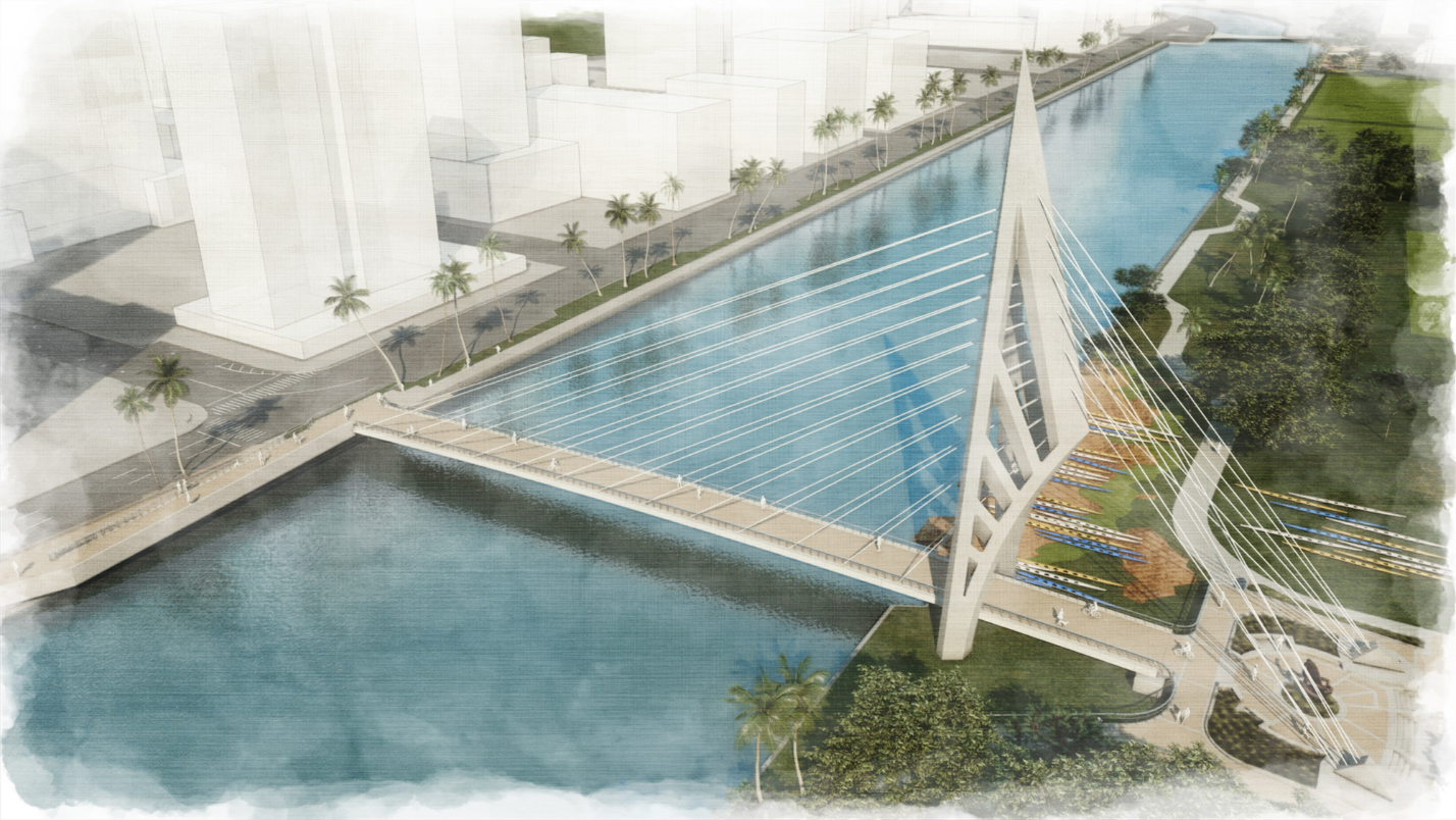
- Ala Pono (Ala Wai Bridge)
- Kalākaua Avenue Crossing Improvements
Upcoming and Current Projects
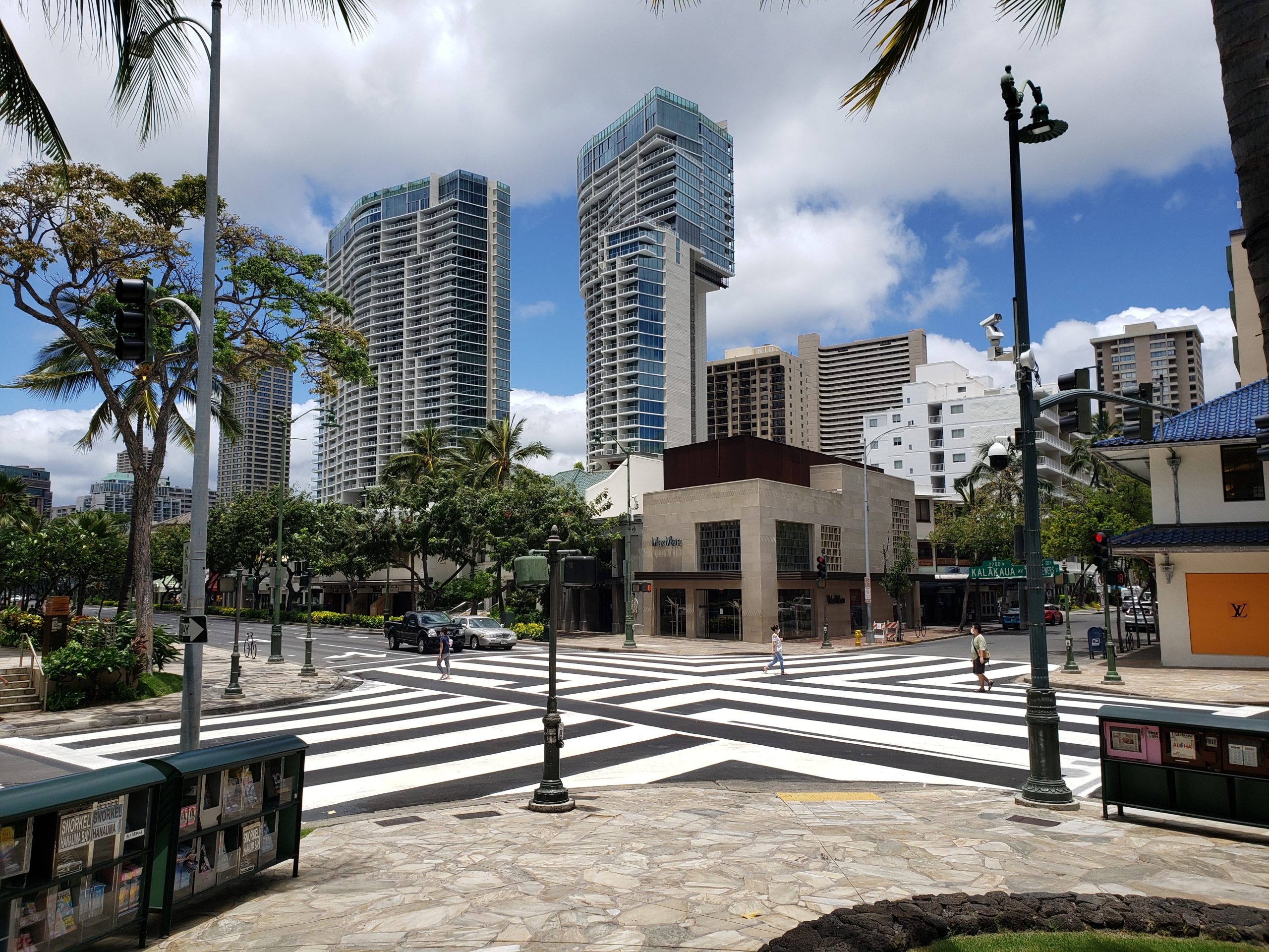
Kalākaua Avenue Crossing Improvements
In April 2020, the City installed new crosswalk markings to enhance the Barnes Dance pedestrian crossing at the intersection of Kalākaua Avenue and Lewers Street. The Barnes Dance, or All-Way Crossing, provides an exclusive phase when only pedestrians can cross the street and is a proven pedestrian safety measure. The new crosswalk design provides greater visibility to the crosswalk and attention to crossing pedestrians.
As part of the upcoming resurfacing of Kalākaua Avenue, the remaining Barnes Dance crossings will be upgraded with the same improved striping as at Lewers Street. The project will also make safety and comfort improvements to the existing bike lane on Kalākaua Avenue. These include:
- Royal Hawaiian Avenue
- Seaside Avenue
- Kaʻiulani Avenue
- Liliʻuokalani Avenue
- Paoakalani Avenue
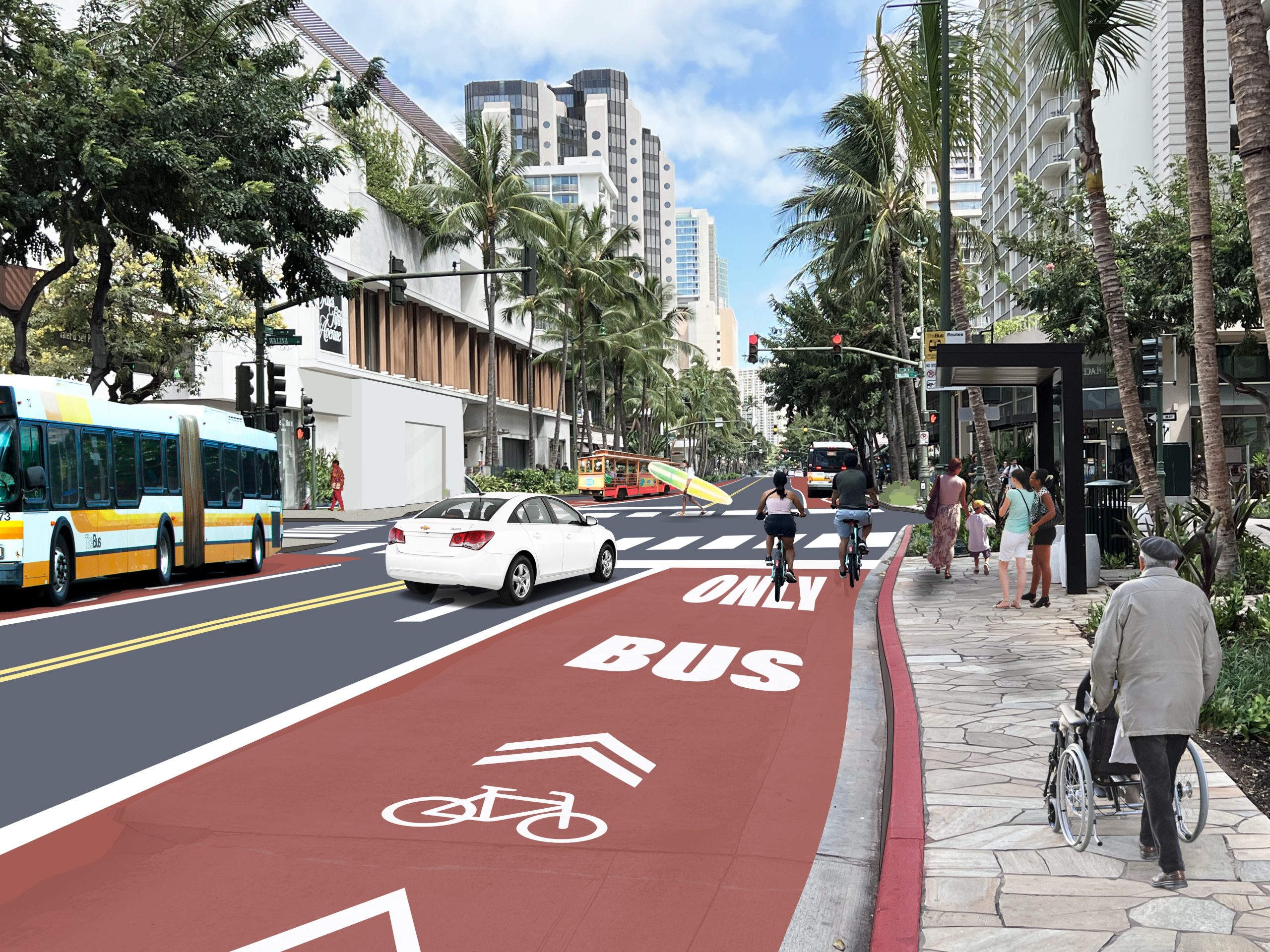
Kūhiō Avenue Bus-Priority Lanes
The City and County of Honolulu is planning its next bus-priority lane project on Kūhiō Avenue from Olohana Street to Kapahulu Avenue. Following the success of the King Street bus-only lane project, which improved bus travel times by as much as 20-30%, bus-priority lanes on Kūhiō Avenue will make more effective use of limited right-of-way space in the dense Waikīkī neighborhood. The intent of this project is to reduce operational delays due to traffic congestion for buses in Waikīkī. Currently, 56% of people on Kūhiō Avenue at rush hour are walking, biking, or riding the City bus or private bus carrier; only 44% of all travel is made by car. The proposed improvements will increase the speed of buses and enhance the rider experience, making buses a more reliable, affordable, and convenient way to travel for local residents, employees, and visitors in Waikīkī.
The project promotes the multimodal transportation objective of the Waikīkī Special District (Sec. 21-9.80-1): “Support efficient use of multimodal transportation in Waikiki, reflecting the needs of Waikīkī workers, businesses, residents, and tourists. Encourage the use of public transit rather than the private automobile, and assist in the efficient flow of traffic.” Use of the bus-priority lane will be limited to City buses, private bus carriers, bicyclists, and right-turning vehicles at designated areas. Commercial loading along Kūhiō Avenue will be restricted. Vehicular access to driveways along Kūhiō Avenue will continue throughout the project, though certain turning restrictions such as “no left-turns” may apply. Signage and red pavement markings will be installed to communicate transit-priority. The project is receiving support from the Bloomberg American Cities Climate Challenge and its partners.
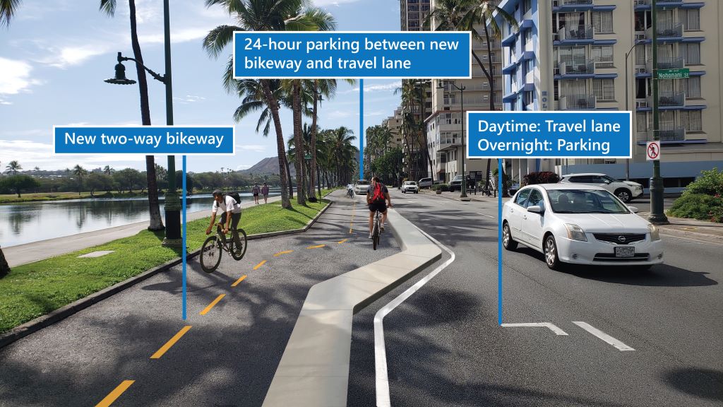
Ala Wai Boulevard
In coordination with the Ala Wai Bridge and University/McCully/Metcalf Complete Streets projects, the City Department of Transportation (DTS) is evaluating potential roadway safety improvements along Ala Wai Boulevard, including pedestrian crossing upgrades, speed limit reduction to 25 mph, curb extensions, lighting improvements, time‐of‐day parking changes, and a two‐way protected bikeway, as recommended in the Oʻahu Bicycle Plan.
This would be the first protected, low‐stress bikeway in Waikīkī. In October 2022 the second community meeting was held to present design concepts and gather feedback. Additional community input was received, and high‐level plans were completed in Spring 2023, though DTS is continuing to work with the community to refine the design plans.
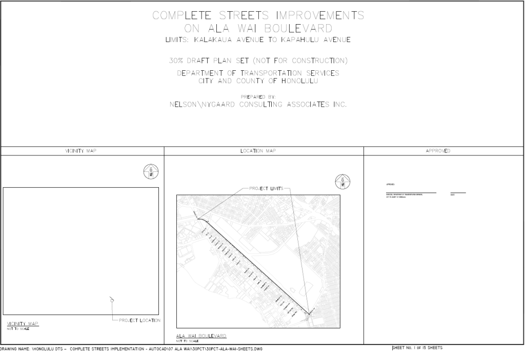
Plans
Click image to view and download a PDF of the proposed roadway plans and safety concepts.
If you require an auxiliary aid/service, other accommodation due to a disability, or an interpreter for a language other than English, to read these plans, please call Daniel Alexander at (808) 768-6652 or email completestreets@honolulu.gov.
Community Meetings
Ala Pono (Ala Wai Bridge)
The purpose of the project is to provide safe access for people traveling by foot or by bicycle across the Ala Wai Canal between Ala Wai Boulevard and the Mānoa/Pālolo Stream. The project’s primary goal is to improve multimodal network connectivity and enhance public safety for people walking and bicycling. Secondary goals are to ensure comfortable and sustainable mobility options that enhance economic vitality, environmental health, social equity, and recreational opportunities. Further, the proposed bridge would provide a modern, artistic, and vibrant element to the area that is inspired by the native, cultural aspects of the canal and Waikīkī. To learn more about the project, check out our Ala Pono project page.
For questions and/or comments on the Ala Pono project, please contact project manager Peter Garino at (808) 768-6651, or via email at peter.garino@honolulu.gov.
Interactive Map
Click on the interactive map to view community comments about issues residents encountered, or ideas community members have to make the area safer and more accessible for all.