The City and County of Honolulu continues to implement Complete Streets improvements and new design solutions to advance safety and mobility for all. The following completed projects highlight our work all across Oʻahu.
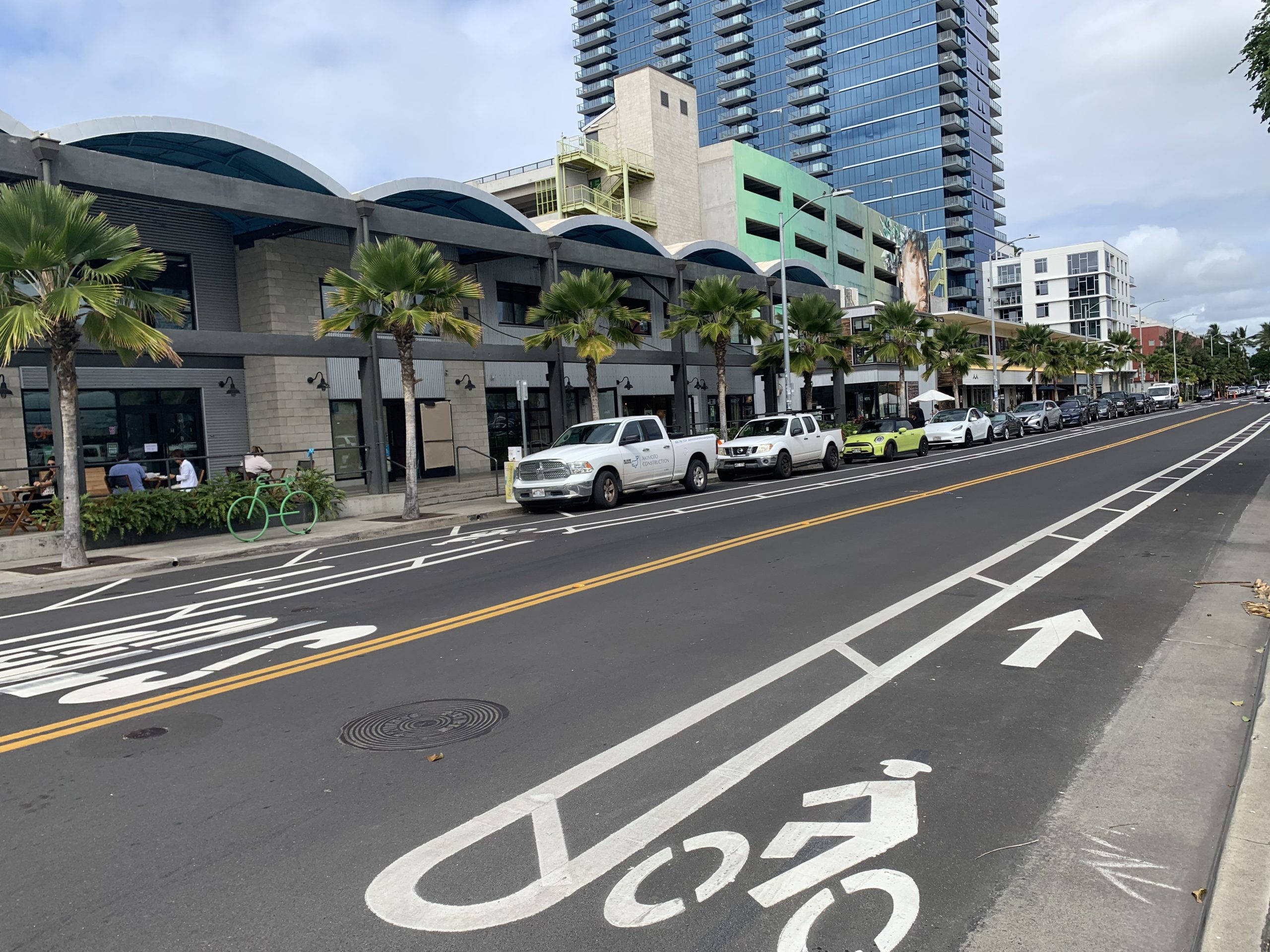
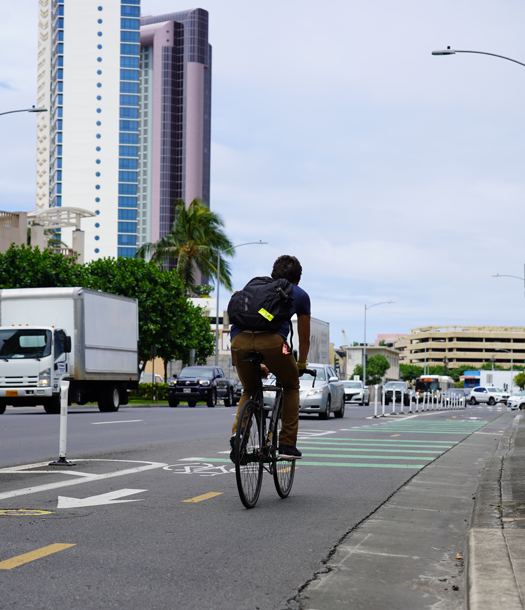
Kakaʻako Bike Lanes
Our Department of Design and Construction (DDC) recently installed new bike lanes along Auahi Street, Cooke Street, Pohukaina Street, and Kamakeʻe Street in Kakaʻako as part of a roadway repaving and rehabilitation project, along with new curb ramps throughout the district. Howard Hughes Corporation is also installing new bikeways along Kamakeʻe and Auahi Streets.
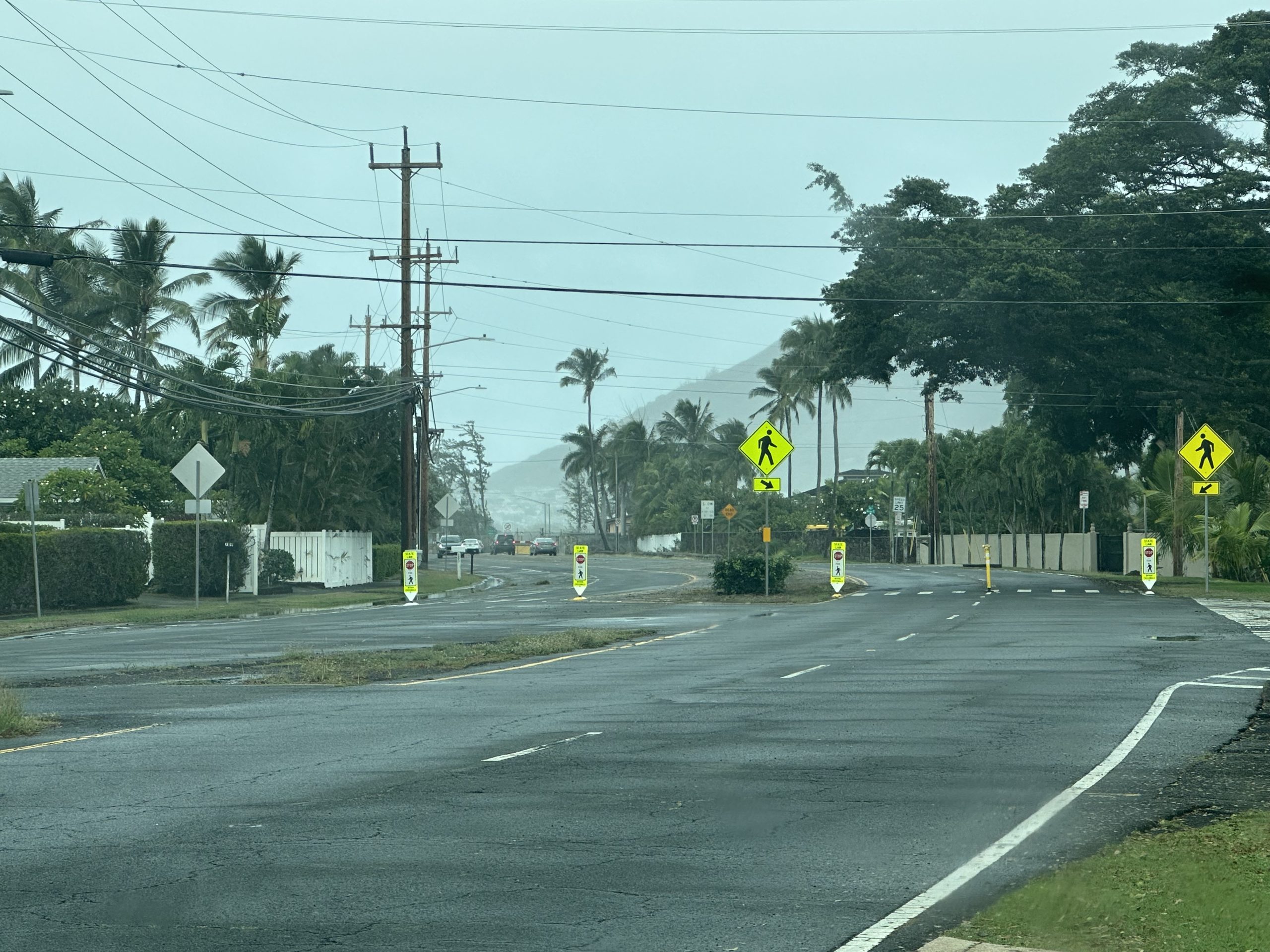
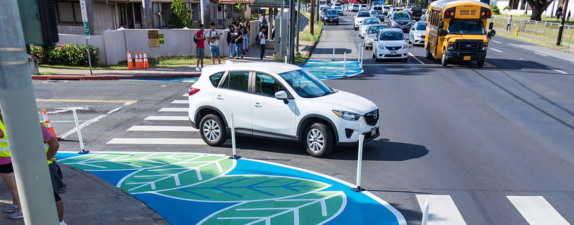
Mōkapu Road, Kailua
At two locations on Mōkapu Road, the Department of Transportation Services installed a crosswalk gateway treatment, which is a quick-build crosswalk and safety enhancement that uses a combination of traditional signs and in-street delineators and signs to highlight the presence of the crosswalk ahead, and slow vehicles approaching. At Mōkapu Road and ʻAikahi Loop, DTS also replaced fading road signs and added new roadway markings.
Oneawa Street, Kailua
On Oneawa Street, the Department of Transportation Services modified the crosswalk between Uluniu Street and Kuʻulei Street. The work includes new pedestrian crossing signs to indicate presence of the crosswalk ahead, and where drivers should stop. The crosswalk was also improved with a quick-build safety enhancement using delineators and tuff curbs to better define the pedestrian island in the middle of the crosswalk.
Kamaʻaha Avenue, Kapolei
At Kamaʻaha Avenue and Kapolei Parkway, the DTS modified the intersection movements using quick-build materials and strategies. The existing straight through and left turn lanes for Kamaʻaha Avenue were restricted until a future traffic light is installed. Right turns are allowed from Kamaʻaha Avenue onto Kapolei Parkway. On Kapolei Parkway, installation of a crosswalk gateway treatment, which is a quick build crosswalk and safety enhancement that uses a combination of traditional signs and in-street delineators and signs. This treatment works to highlight the presence of the crosswalk ahead and slow approaching vehicles.
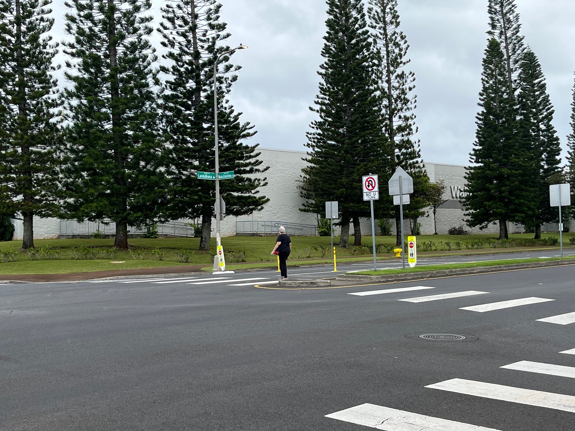
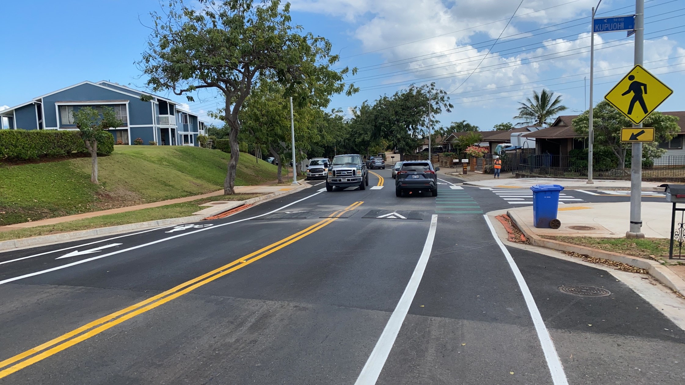
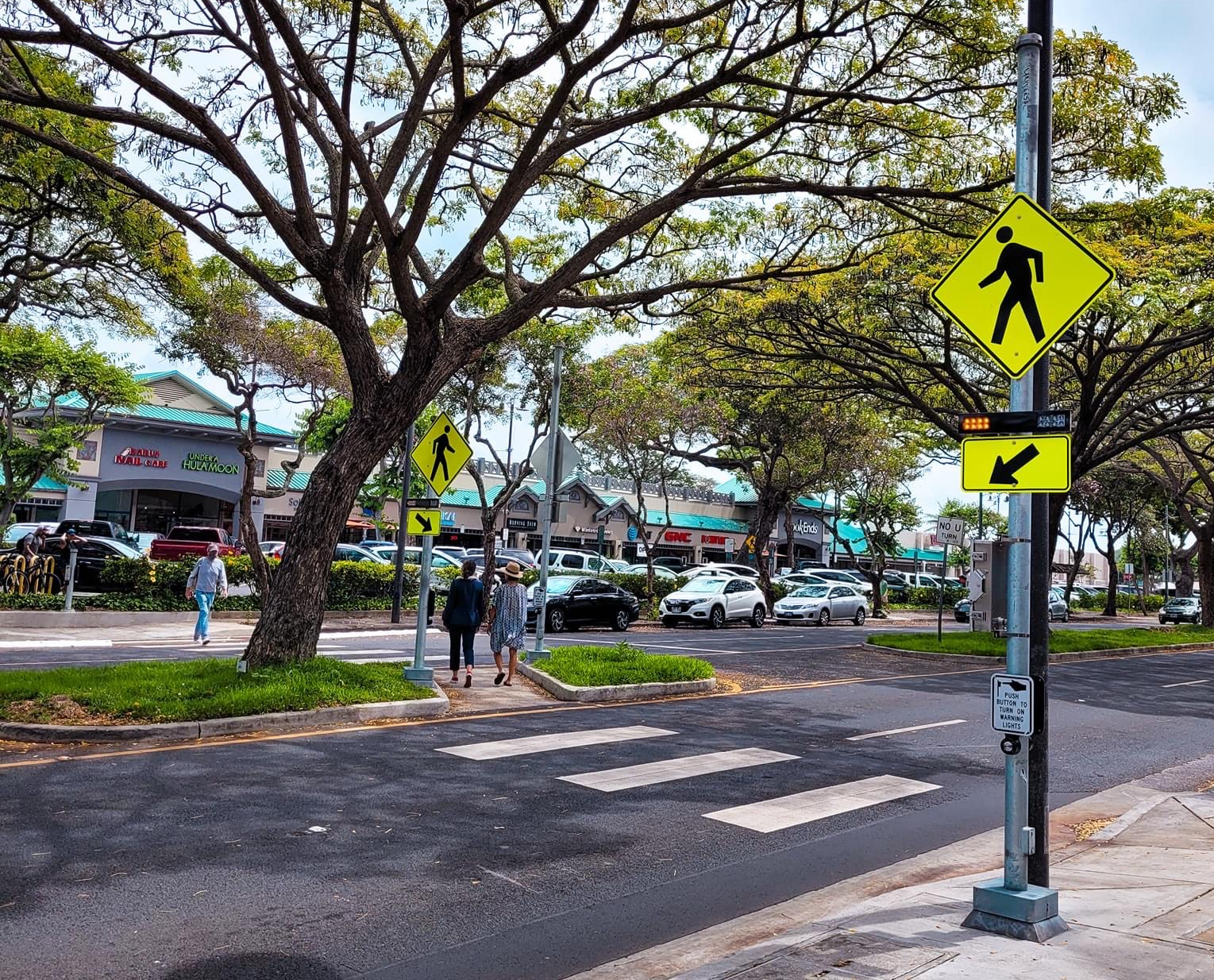
Lanikūhana Avenue, Mililani
On Lanikūhana Avenue at Makaʻimoʻimo Street, the Department of Transportation Services installed a crosswalk gateway treatment, which is a quick-build crosswalk and safety enhancement that uses a combination of traditional signs and in-street delineators and signs to highlight the presence of the crosswalk ahead, and slow vehicles approaching.
Pensacola Street Raised Crossings
The Department of Transportation Services (DTS) in partnership with the Hawaiʻi State Department of Transportation (HDOT) installed raised crosswalks near McKinley High School on Pensacola Street at four intersections on Elm, Rycroft, Hoʻolaʻi, and Kamaile Streets. In an effort to increase safety, reduce motor vehicle speeds and to prevent collisions on these heavily used crossings of McKinley High School students and residents of the surrounding neighborhood. Speeding is a heavy concern along the multi-lane roadway, given the proximity of the high school and other community destinations.
Goodale Avenue Multi-Use Path
As a response to long-standing pedestrian and bicyclist safety concerns of the community, the Goodale Avenue Multi-Use Path project was completed in Spring 2023. It has implemented pedestrian and bicycle improvements along Goodale Avenue and Kealohanui Street, adjacent to Waialua District Park. Upgrades included the installation of a paved multi-use path for non-motorized users protected from vehicular traffic by a concrete curb. Traffic calming features were put in place along with new fencing and landscaping.
Fern Elementary Safe Routes to School
Delivered through the City’s Safe Routes to School Program, the City completed a “Keiki Corridor”, a separated guideway that allows children and residents to safely traverse on foot along Kahauiki Street and Kamehameha IV Road. This path along Kahauiki Street is a main pathway for students to and from Fern Elementary School.
Prior to the completion of the Keiki Corridor, students and pedestrians had to walk onto the street, to get around parked cars or bulky items. This proved to be dangerous for not only residents of the neighborhood, but for the keiki and students that traverse to school every day.
The Keiki Corridor stretches roughly 0.4 miles and is lined with plastic curbs and delineators. The intersection of Kamehameha IV Road and Kahauiki Street was also changed to an All-Way stop. No Parking signage was also installed along the corridor to prevent cars from blocking the path.
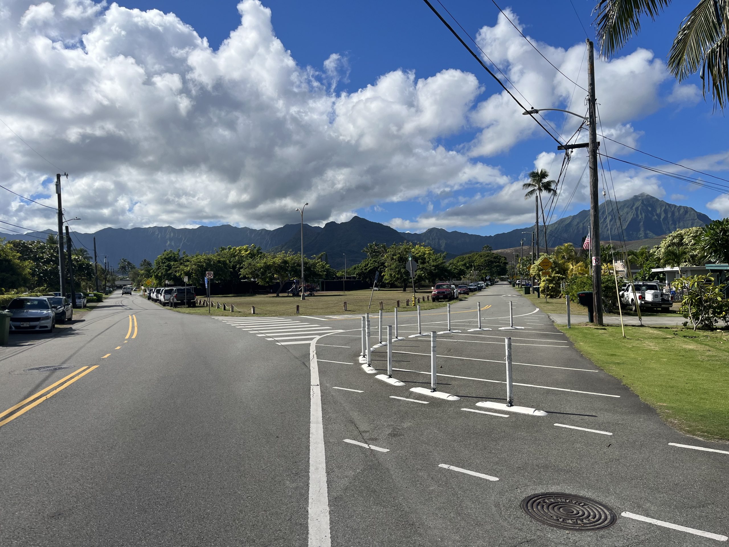
Village Park - Kupuna Loop Improvements
The Department of Transportation Services’ Transportation Engineering Division completed new raised crosswalks, curb extensions, and two roundabouts along Kupuna Loop in Kunia in response to community calls for safer streets. The stamped-concrete roundabouts help to reduce fatal and injury crashes by up to 90% by minimizing conflicts and slowing vehicles as they travel through the intersections. Additionally, the project piloted the City’s first use of “speed cushions” (i.e., speed humps) that slow passenger vehicles yet allow large buses and emergency vehicles to pass through without slowing down.
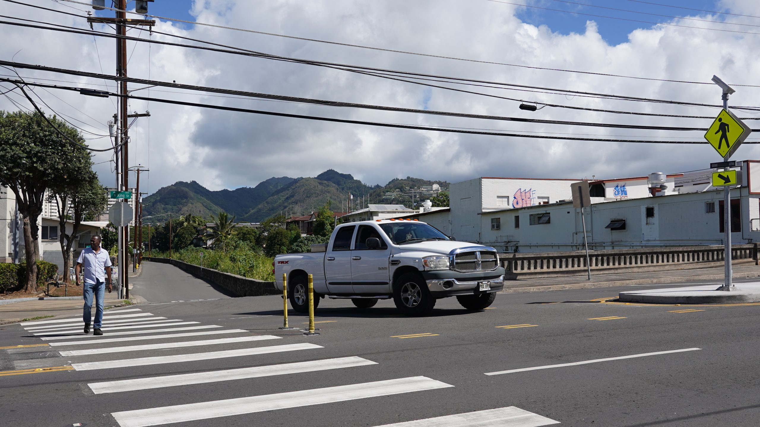
North King Street/Richard Lane Pedestrian Crossing Improvements
In November 2022, the City completed installation of its second Rectangular Rapid Flashing Beacon (RRFB), commonly known as a pedestrian crossing beacon, to enhance pedestrian safety on North King Street at the intersection of Richard Lane. These devices use LED lights that flash with high frequency when activated to improve pedestrian visibility and driver yielding. They have been shown to reduce pedestrian-driver collisions by nearly 50%. Future RRFBs are planned on other uncontrolled crosswalk locations in Kalihi and on Oʻahu.
In addition to the RRFB, the project constructed a median space to limit pedestrian exposure when crossing the road and allow pedestrians to focus on crossing one direction of traffic at a time.
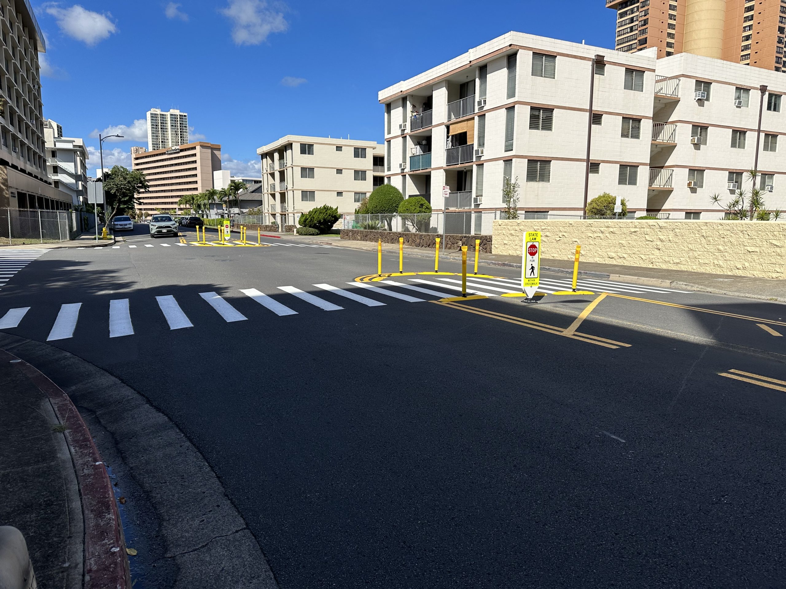
Ala ʻIlima Street Quick-Build Pedestrian Refuge Island
In November 2022, the City installed an interim pedestrian refuge island along the busy and wide stretch of Ala ʻIlima Street at the intersection of Ala Napuaʻa Place. The interim pedestrian crossing improvement, designed by in-house traffic engineering staff, uses low-cost modular materials to create a median space that limits pedestrian exposure and allows pedestrians to focus on crossing one direction of traffic at a time. Design for permanent improvements and a potential road diet are programmed, pending the availability of funds.
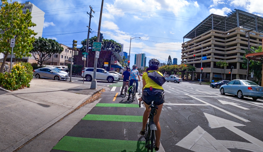
Alakea Street Protected Bike Lane
In March 2022, as part of a roadway repaving project, a protected bike lane was installed on Alakea Street between South King and Hotel Streets. This one-block mauka-bound bikeway serves as an important bikeway network connection in the heart of downtown Honolulu with the upcoming extension of the South King Street protected bikeway to Alakea Street. The King Street extension will begin in the coming year as part of a separate roadway paving project that will also install new bikeways on Punchbowl and Richards Streets. In November 2022, an extension of the protected bikeway from Nimitz Highway to South King Street was completed.
Kailua Road Pedestrian Crossing Improvements
In March 2022, the City completed installation of its first Rectangular Rapid Flashing Beacon (RRFB), commonly known as a pedestrian crossing beacon, to enhance pedestrian safety on Kailua Road. These devices use LED lights that flash with high frequency when activated to improve pedestrian visibility and driver yielding. They have been shown to reduce pedestrian-driver collisions by nearly 50%. Similar installations are planned on other uncontrolled crosswalk locations on Oʻahu.
In addition to the RRFB, the Kailua Road project also relocated the crosswalk from its previous location near Maui Brewing Company to the entrance of Kailua Town Center by California Pizza Kitchen, where sight lines are better, and a new bicycle parking “corral” is being installed fronting Lanikai Juice. These improvements were made possible by a $100,000 contribution by Alexander & Baldwin.
McCully Mini-Traffic Circle
In response to the “Slow Streets” project that was piloted in the McCully neighborhood in May through June 2021, the City received numerous requests for more-semi-permanent installations to help curb speeding at the intersection of Waiola and Wiliwili Streets – an important connector between community destinations in the McCully-Mōʻiliʻili neighborhood.
In November 2021, the City’s Department of Transportation Services installed a new mini traffic circle to help curb speeding at this intersection. Mini-traffic circles are designed for small intersections and help to slow down traffic in neighborhoods at unsignalized intersections.
A recent traffic analysis showed that the mini-traffic circle to be extraordinarily effective in reducing speeding, with nearly 100% of vehicles now traveling along Waiola Street at or under the speed limit of 25 MPH. In contrast, at the adjacent intersection of Citron and Wiliwili Streets, 37% of vehicles on Citron Street are traveling above the speed limit, some going faster than 40 MPH.
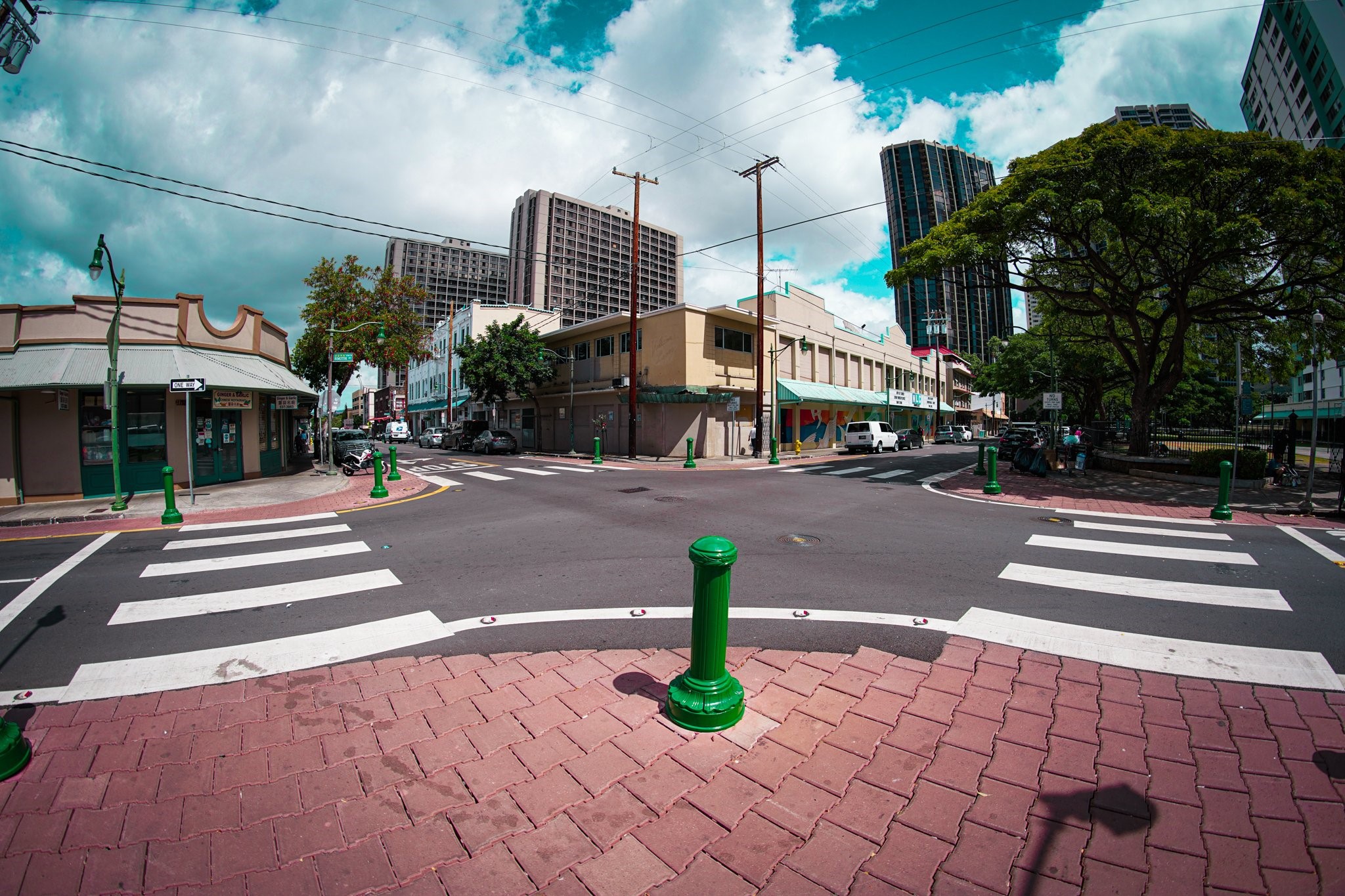
Chinatown Curb Extensions
In July 2017, pilot curb extensions (i.e., bulbouts) were constructed along North Pauahi Street at the Nuʻuanu Avenue, Smith Street, and Maunakea Street intersections. The pilot project allowed for design testing and adjustments, and a safety evaluation found that the features reduced crashes at those intersections by nearly 40%. Curb extensions improve safety by reducing pedestrian crossing distances, enhancing visibility between drivers and pedestrians, and slowing the speed of turning vehicles.
In 2021, as part of an roadway repaving project, the curb extensions along North Pauahi Street at the Smith, Nu’uanu, and Maunakea Streets were upgraded with higher-quality materials. The curb extensions feature brick-colored pavers and decorative green metal bollards to protect the expanded space, and tacticle warning devices for visually impaired pedestrians.ʻ
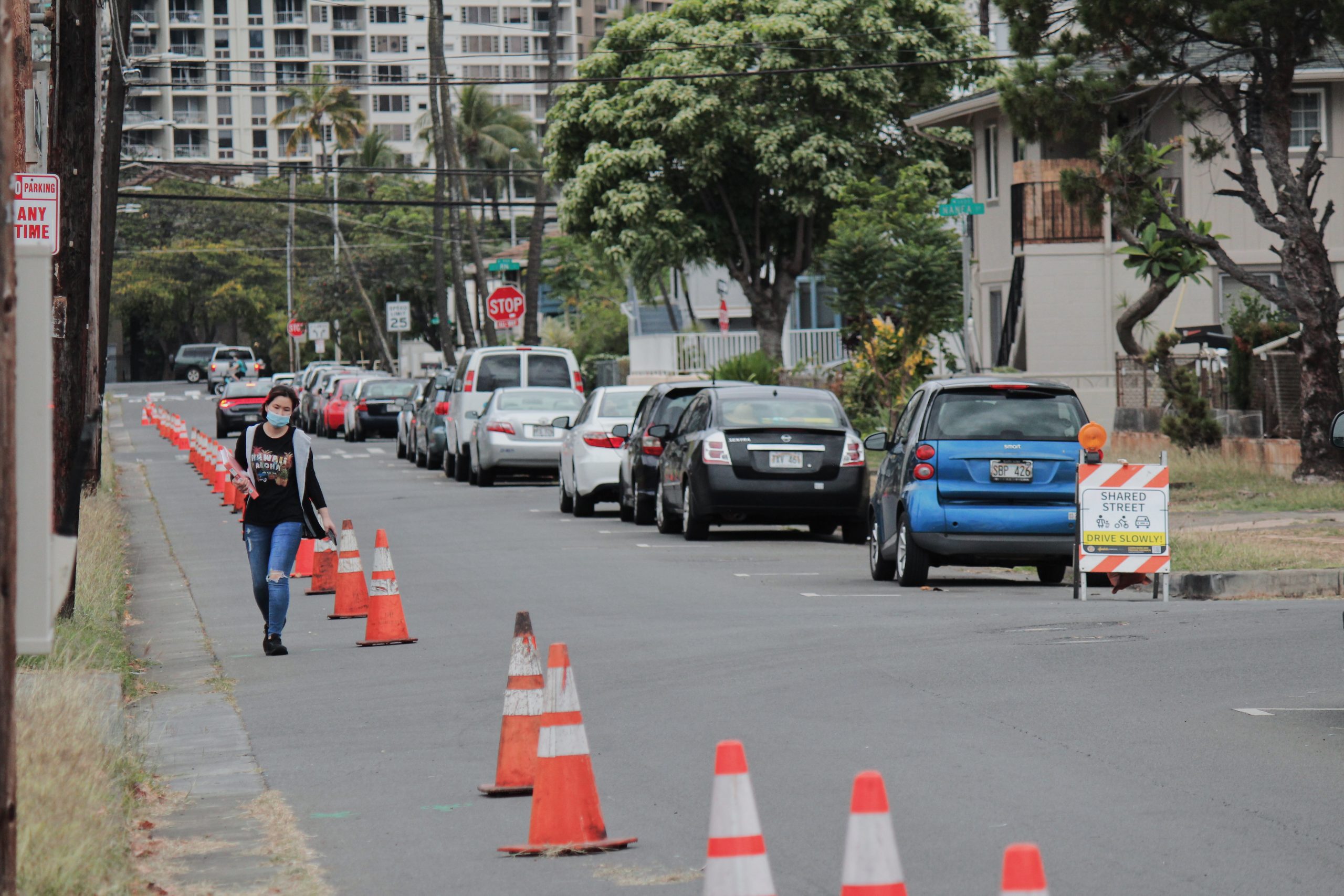
McCully Shared Streets Pilot
With support from the American Cities Climate Challenge, the City piloted Shared Streets and quick-build strategies in the spring of 2021 to quickly provide safer streets for people walking and rolling in the McCully/Mōʻiliʻili neighborhood. Over one third of McCully/Mōʻiliʻili residents commute by walking, biking, or taking public transit, and 75.5% of households own one or zero vehicles. Shared Streets aimed to immediately provide low-street connections through the McCully/Mōʻiliʻili neighborhood to key destinations and existing bikeways along King Street and the Ala Wai Canal.
The installations provided dedicated space for non-motorized travel and discouraged cut-through traffic and speeding using temporary traffic control materials. A pop-up bike/walk lane was installed along the Diamond Head-side of Hauʻoli and Pumehana Streets, and in-road signage was used along Waiola Street. The temporary project lasted for 60 days starting May 1, 2021.
The Shared Streets pilot project demonstrated a clear need for paved and protected space for pedestrians, wheelchairs, strollers, scooters, skateboards, bikes, and so on. The City is now considering semi-permanent walk/bike lanes on Hauʻoli and Pumehana Streets.
Click below to view or download the McCully Shared Streets Report and Pilot Flyer.
In August 2021, the City finished reconstructing the shared-use pathway along Paki Avenue from Kapahulu to Monsarrat Avenues. The project replaced the existing asphalt pathway with a wider, concrete sidewalk, while addressing tree roots and branches that were immediately impacting the pathway. These improvements helped to increase pedestrian and bicyclist circulation along this popular pathway and helped to make it more accessible. No tree removals were required for this project.
A separate project to address the half-mile stretch of the pathway from Monsarrat Avenue to Poni Moi Road is expected to begin within a year.
North King Street Quick-Build Pedestrian Refuge Island
In January 2021, the Department of Facility Maintenance (DFM) installed an interim pedestrian refuge island on North King Street at Morris Lane in Kalihi. The pedestrian crossing improvement, uses modular materials to create a median space that limits pedestrian exposure and allows pedestrians to focus on crossing one direction of traffic at a time. Design for permanent improvements are programmed in parallel to the Kalihi Complete Streets project.
California Avenue Quick-Build Pedestrian Refuge Island
In June 2021, the Department of Facility Maintenance (DFM) installed an interim pedestrian refuge island along the busy and wide stretch of California Avenue near Makani Street. The interim pedestrian crossing improvement, designed by in-house traffic engineering staff, uses low-cost modular materials to create a median space that limits pedestrian exposure and allows pedestrians to focus on crossing one direction of traffic at a time. Design for permanent improvements and a potential road diet are programmed, pending the availability of funds.
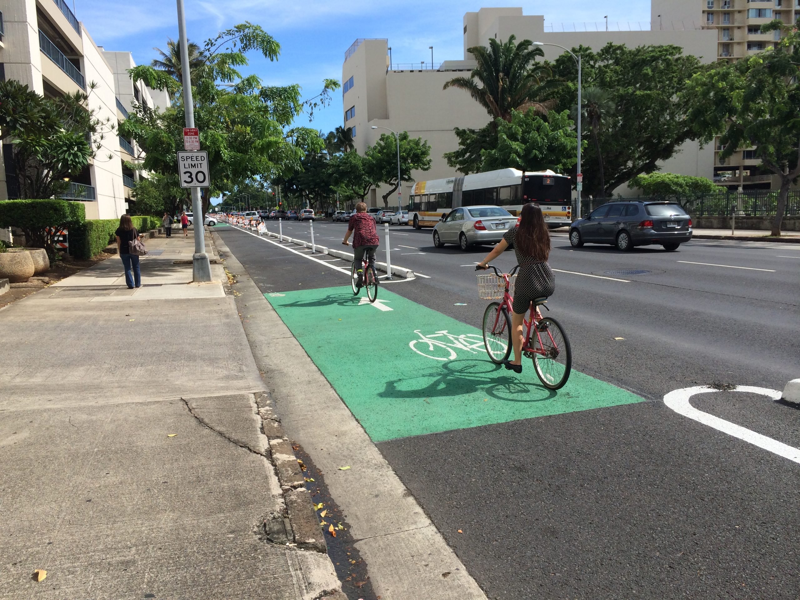
Ward Avenue Protected Bike Lane
May 2021, new protected bike lanes along Ward Avenue from South King Street to Ala Moana Boulevard were opened to the public. The new bike lanes run in the mauka and makai directions on each side of the street and provide a direct connection to the King Street protected bike lane. A three-foot buffer lined with delineators defines and protects the bikeway, with green painted stripes marking conflict zones at driveways and intersections.
The improved connectivity will provide better connections between the waterfront, the growing Kakaʻako district while increasing the number of residences, jobs, services, and entertainment options accessible by people who are not comfortable biking in mixed traffic. The bike lane is also expected to improve pedestrian safety and protect our most vulnerable roadway users by removing bicycles off narrow sidewalks and increasing the separation and visibility between the sidewalk and the roadway.
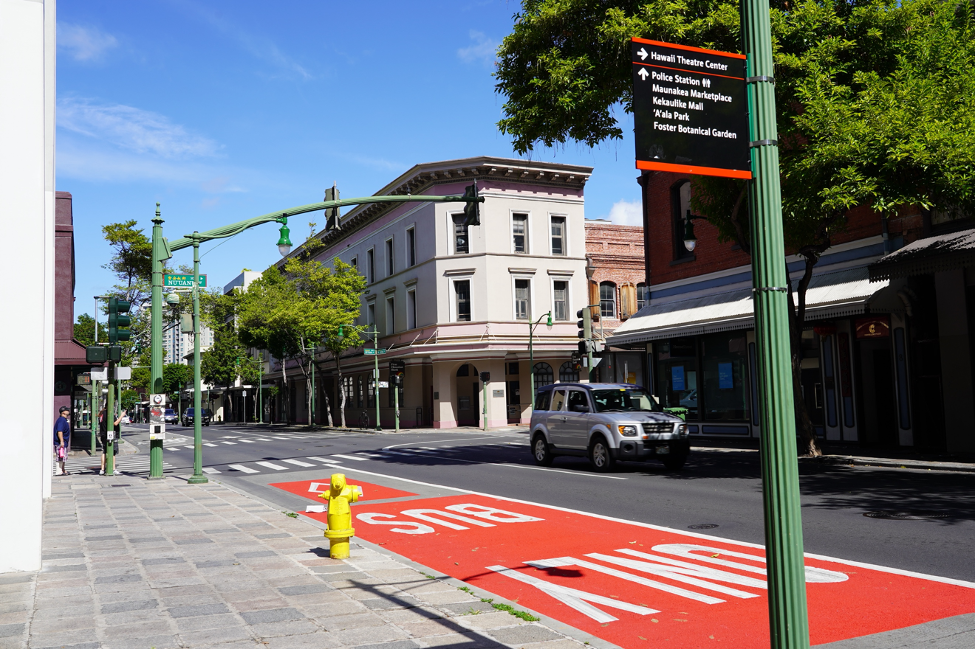
King Street Bus-Only Lane
In December 2020, the City opened its first bus-only lane on King Street. TheBusLane is the rightmost travel lane on eastbound King Street from Dillingham Boulevard, travels through Chinatown and Downtown, and ends (for now) at Punchbowl Street. As the state’s busiest transit corridor, King Street serves over 36 different bus routes coming from Leeward and Central Oahu and the North Shore. Reducing congestion delays improves bus service and safety, helps riders get to their destinations quicker, and lowers transit operating costs.
New signs and pavement markings include red paint in the rightmost lane indicating transit priority. Vehicles making right-hand turns will be allowed into the bus lane, and delineators have been installed at the corner of King and Punchbowl Streets to prevent vehicles from cutting off buses.
The King Street bus-only lane reduced bus travel times by 20-30%, improve bus reliability by 11-17%, and saved the City up to $560,000 per year in operating expenses.
In September 2020, a two-way protected bike lane on Pensacola Street from Wilder Avenue to Kapiʻolani Boulevard was opened to the public. The bike lane runs in the mauka and makai directions on the Diamond Head side of the street and connects to the King Street protected bike lane. A three-foot buffer lined with delineators defines and protects the bikeway with green stripes marking conflict zones at driveways and intersections. The connectivity will provide better access to essential jobs and services for the Makiki and Ala Moana neighborhood residents, neighborhoods that already have higher rates of bicycling, and lower rates of car ownership than the island average. The bike lane is also expected to improve pedestrian safety and protect our most vulnerable roadway users by removing bicycles off narrow sidewalks and increasing the separation and visibility between the sidewalk and the roadway.
Kalākaua Avenue Barnes Dance
In April 2020, the City installed new crosswalk markings to enhance the Barnes Dance pedestrian crossing at the intersection Kalākaua Avenue and Lewers Street. Originally installed in 2013, the Barnes Dance, or All-Way Crossing, provides an exclusive phase where only pedestrians can cross the street and is a proven pedestrian safety measure. The new crosswalk design provides greater visibility to the crosswalk and attention to crossing pedestrians.
As part of an upcoming roadway resurfacing of Kalākaua Avenue, the remaining Barnes Dance crossings will be upgraded with the same improved striping as at Lewers Street.
These locations include:
Royal Hawaiian Avenue
Seaside Avenue
Kaʻiulani Avenue
Liliʻuokalani Avenue
Paoakalani Avenue
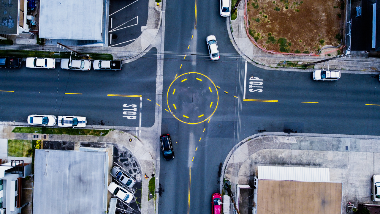
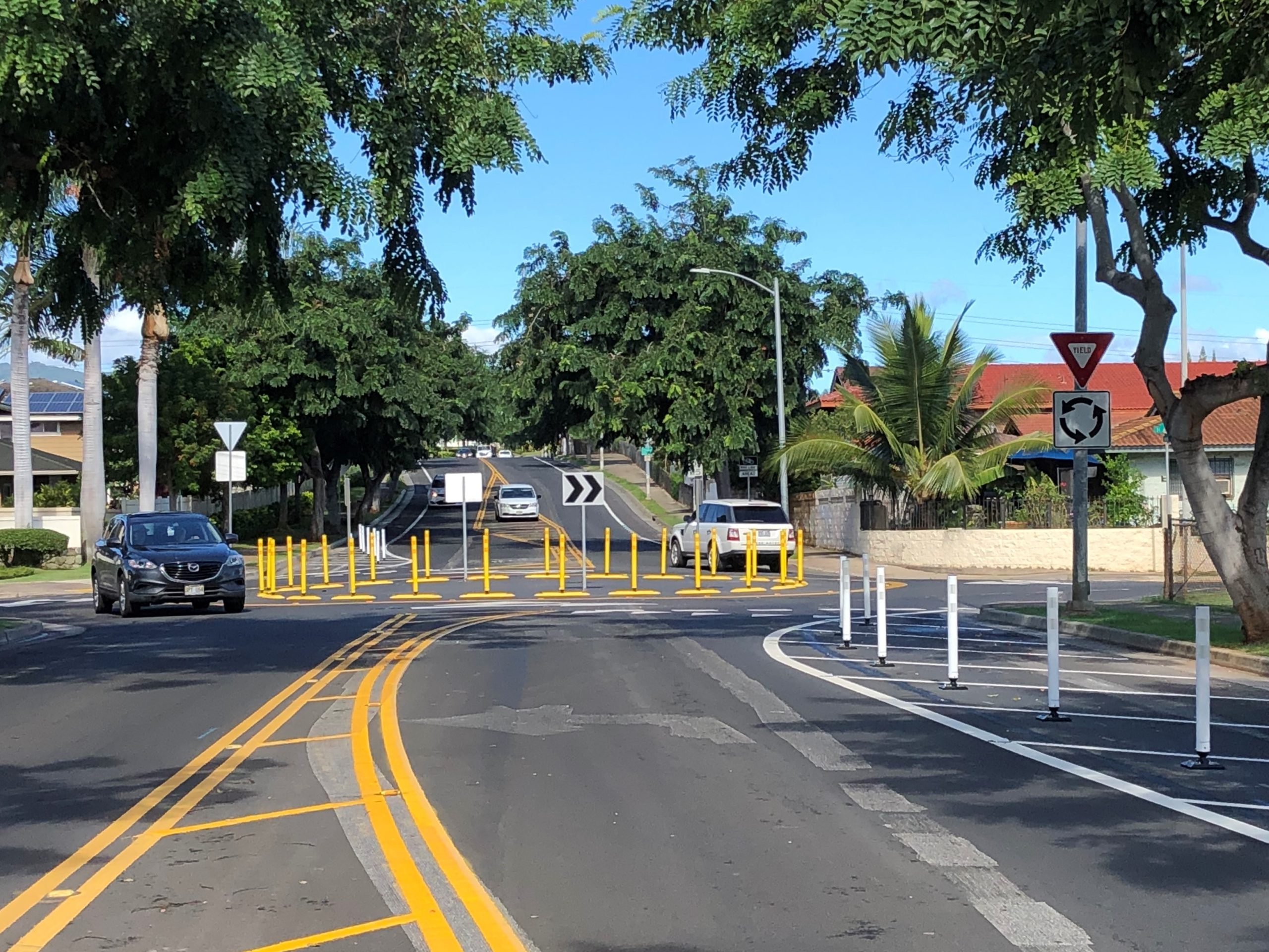
Managers Drive/Hiapo Street Roundabout
In November 2019, a roundabout was installed at the intersection of Managers Drive and Hiapo Street, in the Waipahū neighborhood. A roundabout is a type of circular intersection that permits traffic to flow in the counter-clockwise direction. Using delineators and paint to construct the roundabout, the project replaced a two way stop controlled intersection. The roundabout allows traffic to maintain a steady flow and reduces idle time for vehicles typically spent at conventional intersections. Roundabouts also improve safety for both pedestrians and motorists by significantly reducing the number of conflict points.
Farrington High School Quick-Build Project
In November 2019, interim curb extensions (i.e., bulbouts) were constructed along North King Street at the Mokauea Street, Kalihi Street, and Haka Drive intersections. Delineators and paint were used to extend the sidewalk into the roadway and adjacent parking lane to provide additional pedestrian space and to shorten crossing distances. The project decreased crossing distances by 15 to 40% and crossing times by 15 to 20%.
The Farrington High School Engineering Academy students played an integral role in the Project’s Development, working closely with the City to identify the project locations and to produce a mural design that reflected and enhanced the Kalihi neighborhood.
In May 2018, curbing and Delineators were installed along Aumoe Road at Pouli and Awakea Roads. The reconfiguration of the intersections along Aumoe Road at Awakea and Pouli Roads was installed to improve traffic operations at the intersections and to slow down mauka-bound Aumoe Road motorists turning right onto the side streets. Aumoe Road is intersected by Pouli and Awakea Roads at an angle which allows Aumoe Road to turn right onto the side streets at higher speeds. As such, reconfiguring the intersection closer to 90 degrees helped slow motorists down and improved visibility for motorists entering Aumoe Road from Awakea and Pouli. In addition, speed humps were installed to address recurring speeding concerns (confirmed by speed surveys) along Awakea Road between Aumoe and Wanaʻao Roads.
Lehua Avenue Road Diet
In March 2018, a road diet was constructed as a part of the Lehua Avenue rehabilitation project. Travel lanes along Lehua Avenue, were reduced between 4th Street and 1st Street. Parking lanes and a two-way left turn lane was installed between 4th and 3rd streets. Parking lanes, bike lanes and a two-way left turn lane were added between 3rd and 1st Streets. Road diets improve road safety by reducing the number of collision points and allocating space for pedestrians and bicyclists. The road diet on Lehua Avenue helped to address neighborhood speeding concerns and pedestrian safety issues.
Ala Napunani Street Road Diet
In July 2017, a road diet was constructed as a part of the Ala Napunani Street rehabilitation project. The project reduced the number of travel lanes from four to two and installed a center turn lane. This reduction provided space to install 6-foot wide bike lanes with a 3-foot buffer, in both directions. The project constructed a total of 1.2 miles of bike lanes. Road diets calm traffic, eliminate collision points, and reduce the number of travel lanes pedestrians are exposed to while crossing the street.
South Street Protected Bike Lane
In May 2017, a two-way protected bike lane on the ʻEwa side of South Street from Pohukaina Street to South King Street was opened to the public. A three-foot buffer lined with delineators define and protect the bikeway, with green stripes marking conflict zones at driveways and intersections. A bike box and a two-stage turn queue box at the intersection of Pohukaina Street and South Street, were also installed as a part of the project. These bike improvements on South Street facilitate safe and comfortable bicycle travel and is part of a larger effort to create a network of low-stress bike facilities throughout urban Honolulu.
Old Stadium Park Curb Extensions
In July 2016, curb extensions (i.e., bulbouts) were constructed at the intersection of South King Street and Isenberg Street. Curb extensions extend the sidewalk into the roadway at intersection and mid-block crosswalks. Using asphalt curbs and paint to delineate the extended area, the project created shorter crosswalks, slowed turning vehicles, and improved the visibility of pedestrians at intersections. An analysis of two-year crash data before and after the project shows a nearly 50% reduction in the average number of crashes at the intersection.
Kamehameha IV Road Diet
In March 2016, a road diet was constructed as a part of the Kamehameha IV Road rehabilitation project. Kamehameha IV Road saw the number of its travel lanes reduced from four to two with an added center two-way left turn lane. Bike lanes were also striped in both directions. Road diets improve road safety by reducing the number of collision points and allocating space for pedestrians and bicyclists. The road diet on Kamehameha IV Road reduced traffic related injuries by more than 60%, addressing neighborhood speeding concerns and safety issues.
King Street Protected Bike Lane
In December 2014, the King Street protected bike lane removed one travel lane and created a protected space for bicyclists to travel safely and comfortably through the King Street corridor. Bicycle ridership on King Street increased by more than 90% within the first two years of the project, and the rate of bicycle injuries is on a downward trend. The share of bicyclists riding on the sidewalk also saw a dramatic decrease: Before the project’s construction, nearly 70% of bicyclists traveling through the corridor rode on the sidewalk. The share of bicyclists on the sidewalk decreased to 4% following the construction of the project, with more than 90% of riders using the bike lane.
Protected bike lanes also contribute to a more comfortable and safer pedestrian experience by adding greater separation between the sidewalk and the roadway. The project reduced pedestrian injuries by 50%.
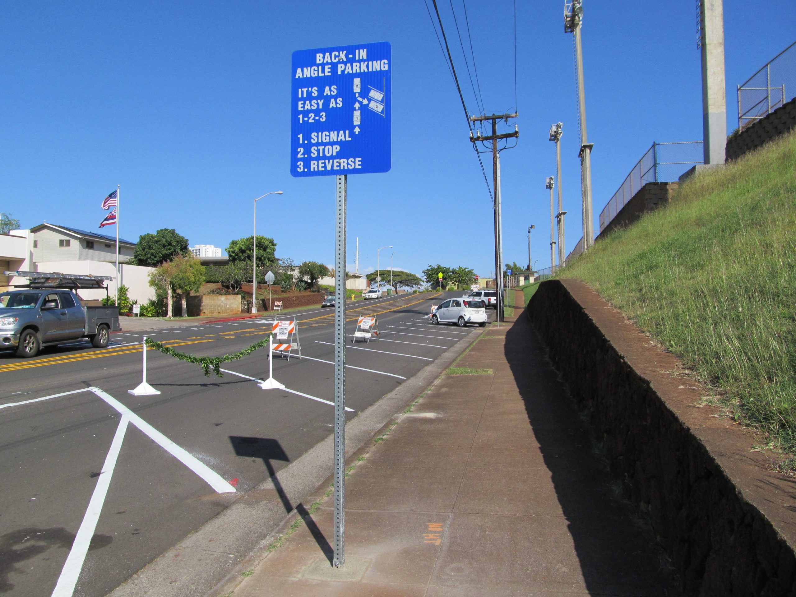
Ulune Street Back-In Parking Stalls
In 2014, reverse angle parking stalls were installed along Ulune Street near ʻAiea High School. Unlike conventional angled parking, back-in angle parking requires motorists to stop, signal, and reverse into diagonal stalls. The design of these stalls improves visibility for drivers exiting a stall, eliminates the risk of collisions resulting from blindly backing out of a stall, and allows convenient and safe unloading and loading. Its angled design also has a traffic calming effect as it visually narrows the roadway and encourages motorists to travel at slower speeds.