The City and County of Honolulu has several Complete Streets projects in the McCully/Mōʻiliʻili and lower Mānoa neighborhoods to improve safety, public health, accessibility, and comfort for all. These projects are envisioned to create a network of streets that are safe and convenient for all people, whether traveling by foot, bicycle, transit, or automobile, and regardless of age or ability.
Projects:
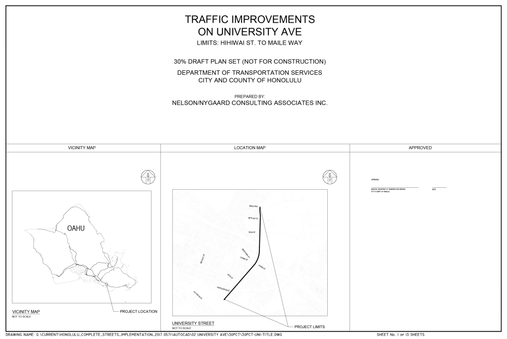
University Avenue Complete Streets project
McCully/Metcalf Street Complete Streets project
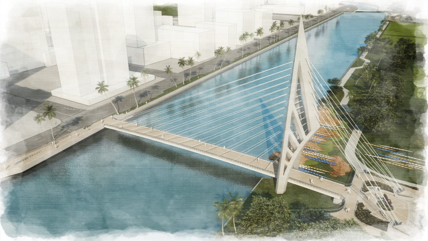
Ala Pono (Ala Wai Pedestrian Bridge)
The Opportunity
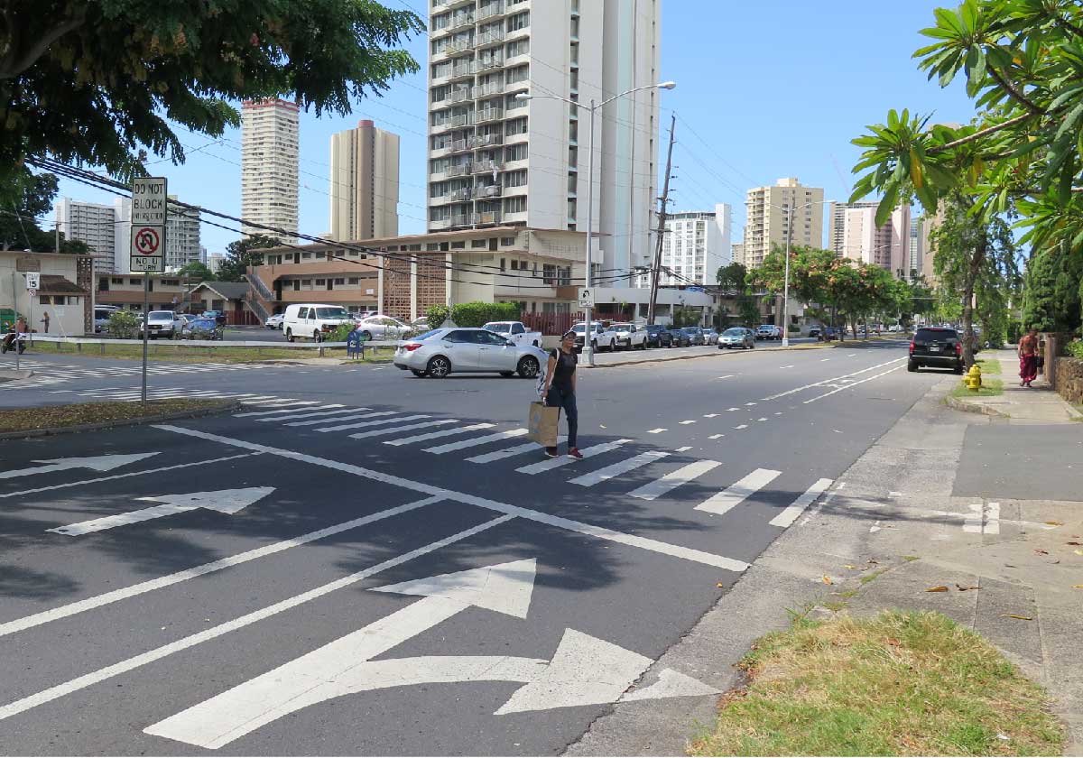
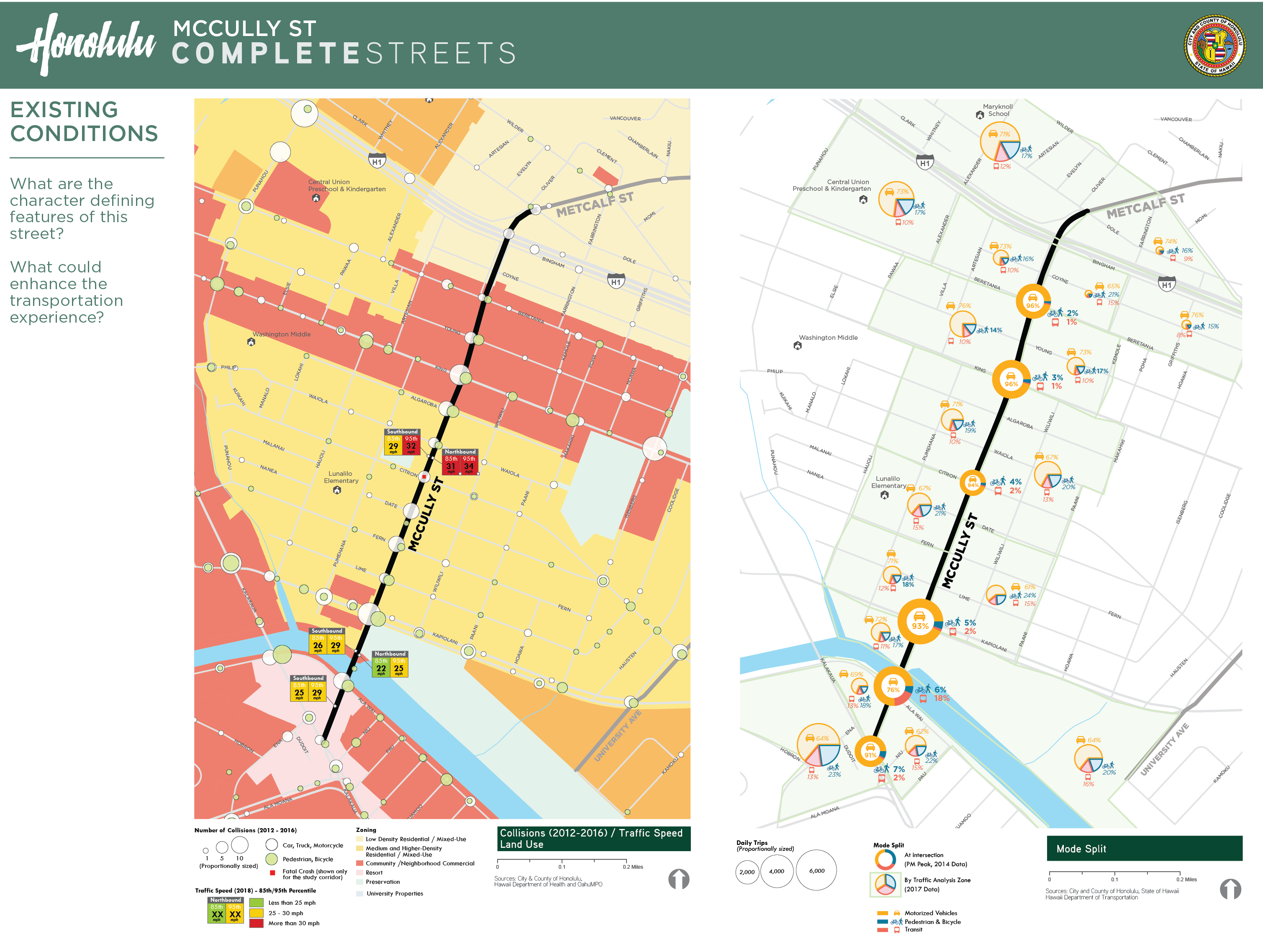
McCully/Mōʻiliʻili and lower Mānoa are vibrant and dense neighborhoods – home to thousands of residents, countless businesses, major community destinations, and the state’s largest university. The community has some of Oʻahu’s highest walking, bicycling, and transit rates and some of its lowest car ownership rates. The existing transportation system supports active transportation mobility in many ways including high-frequency transit and Honolulu’s first protected bike lane.
However, McCully/Mōʻiliʻili and lower Mānoa streets in many ways prioritize motorists, leaving a strong need for improved pedestrian, bicycle, and transit facilities and safety. Additionally, research shows us that there are links between neighborhood design and human health: people who live in neighborhoods with high-quality pedestrian facilities are more likely to walk, and when people feel there is a safe route, they are more likely to consider biking to their destination.
Through its Complete Streets program, the City and County looks to take advantage of scheduled road-paving projects and apply neighborhood-sensitive solutions to improve safety, public health, accessibility, and comfort for all.
The City and County of Honolulu has roughly 900 miles of missing walkways along our local roadways, and building them is a complex and costly endeavor. The new Oʻahu Pedestrian Plan prioritizes our missing walkways based on an analysis that considers factors such as bus routes, proximity to schools, and crash history. Moving forward, pending the availability of funds, the City’s Complete Streets program will explore opportunities to construct walkways along these priority segments, either as stand-alone improvements or part of a periodic roadway and pavement rehabilitation projects.
Locations identified for safety improvements are:
Hauʻoli Street (Kapiʻolani Boulevard to South King Street)
Pumehana Street (Kapiʻolani Boulevard to South King Street)
Kuʻikahi/Citron Street (Waiola Street to McCully Street)
Fern Street (Punahou Street to McCully Street)
Lōkahi/Algaroba Street (Citron Street to Hauʻoli Street)
Date Street (Kapiʻolani Boulevard to Kapahulu Avenue)
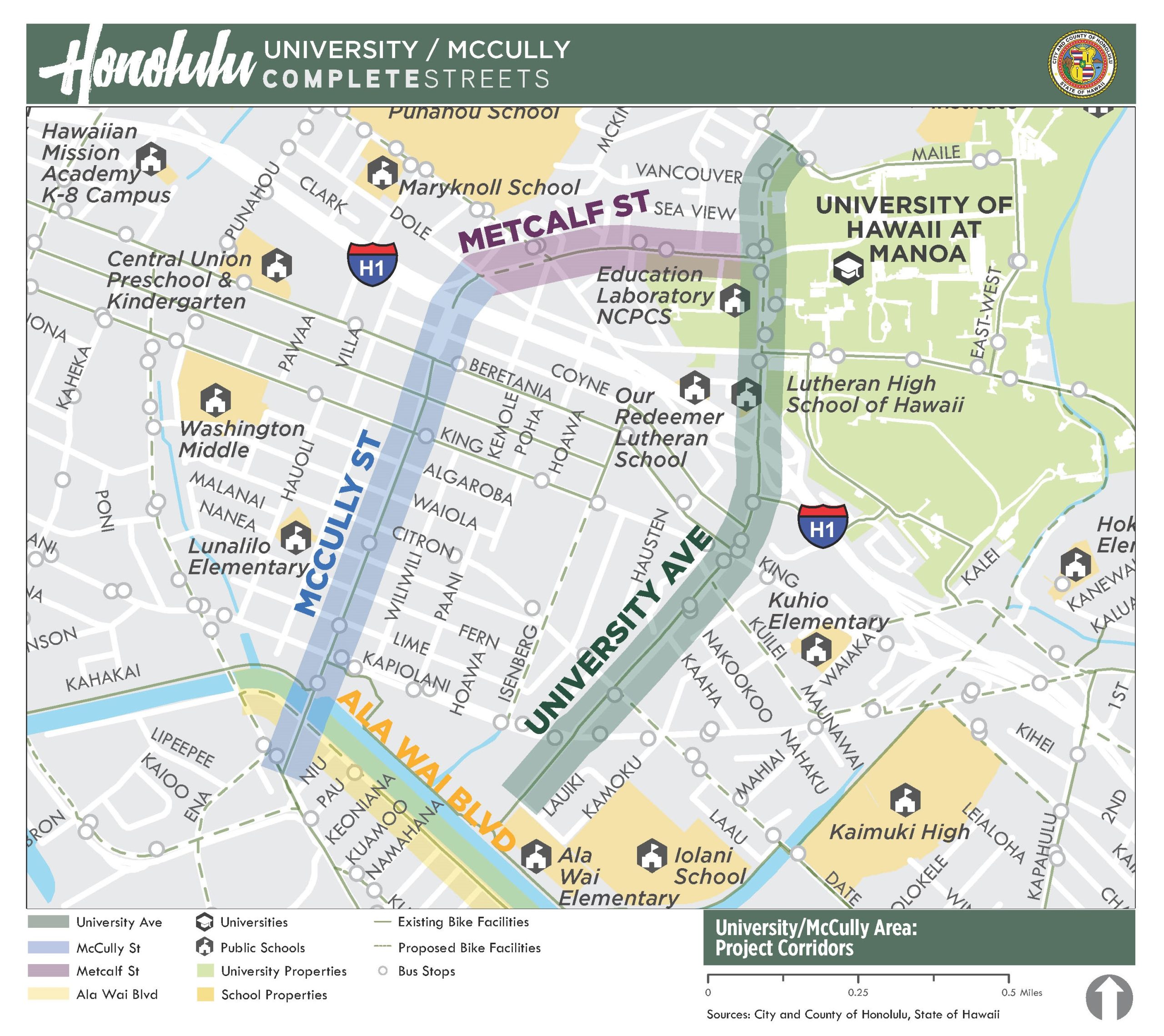
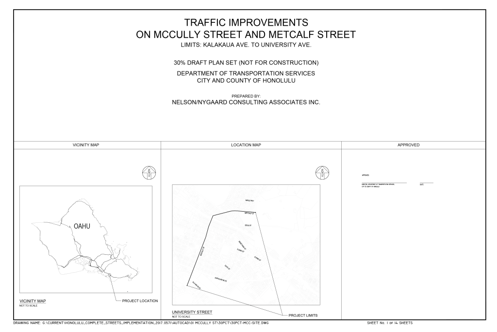
University, McCully, and Metcalf Complete Streets
University Avenue, McCully Street, and Metcalf Street are some of the most important streets connecting within and beyond the McCully/Mōʻiliʻili and Mānoa neighborhoods. In anticipation of upcoming repaving projects, Complete Streets plans were developed jointly for all three streets. This section covers these plans.
Plans
Click thumbnails to view and/or download plans.
If you require an auxiliary aid/service, other accommodation due to a disability, or an interpreter for a language other than English, to read these plans, please call Daniel Alexander at (808) 768-6652 or email completestreets@honolulu.gov.
The purpose of the project is to provide safe access for people traveling by foot or by bicycle across the Ala Wai Canal between Ala Wai Boulevard and the Mānoa/Pālolo stream. The project’s primary goal is to improve multimodal network connectivity and enhance public safety for people walking and bicycling. Secondary goals are to ensure comfortable and sustainable mobility options that enhance economic vitality, environmental health, social equity, and recreational opportunities. Further, the proposed bridge would provide a modern, artistic, and vibrant element to the area that is inspired by the native, cultural aspects of the canal and Waikīkī. To learn more about the project, please check out our Ala Pono project page.
Interactive Map
Click on the interactive map to view community comments about issues residents encountered, or ideas community members have to make the area safer and more accessible for all.